
IMAGES TAKEN NEAR TO
Cranbrook Road, ILFORD, IG1 4UA
Introduction
This page details the photographs taken nearby to Cranbrook Road, IG1 4UA by members of the Geograph project.
The Geograph project started in 2005 with the aim of publishing, organising and preserving representative images for every square kilometre of Great Britain, Ireland and the Isle of Man.

There are currently over 7.5m images from over14,400 individuals and you can help contribute to the project by visiting https://www.geograph.org.uk
Image Map
Images are licensed for reuse under creativecommons.org/licenses/by-sa/2.0
Notes
- Clicking on the map will re-center to the selected point.
- The higher the marker number, the further away the image location is from the centre of the postcode.
Image Listing (50 Images Found)
Images are licensed for reuse under creativecommons.org/licenses/by-sa/2.0
Image
Details
Distance
1
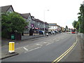
Cranbrook Road, near Ilford
This image looks north along Cranbrook Road, away from Ilford town centre. The photograph was taken during the evening rush hour, but there was a temporary lull in the traffic.
The building on the opposite side of the road is a hotel.
Image: © Malc McDonald
Taken: 31 May 2017
0.01 miles
2
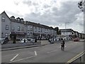
The Rossmore Hotel, Cranbrook Road, Ilford
Image: © David Smith
Taken: 9 Aug 2016
0.02 miles
3
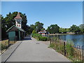
The Lake and Clock Tower, Valentines Park
The mansion is believed to have been originally built in 1696-7, though it was largely reconstructed in the 18th century.
The southern part of what is now Valentines Park was declared officially open to the public "for ever" on 16th September 1899 when it was called Central Park. The grand opening was attended by 10,000 people. At this point Central Park extended to just 47 acres. With further purchases the park was gradually extended to its present size of 136 acres and renamed in the early 20th century.
At the western end of the boating lake, known as The Lake, is the imposing clock tower seen here, presented in the year that the park was opened.
See https://en.wikipedia.org/wiki/Valentines_Park for more information.
Image: © Marathon
Taken: 17 Aug 2016
0.02 miles
4
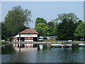
Boat house, Valentines Park
Pay for hire at the left end of the building, but this was a bit too early in the day to be open.
Image: © Robin Webster
Taken: 24 Apr 2011
0.03 miles
5
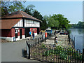
Boat hire base, Valentines Park
No boats were out, but it looked as if things were opening up for the afternoon.
Image: © Robin Webster
Taken: 24 Apr 2011
0.03 miles
6
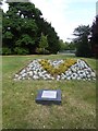
Commemorative plaque and planting, Valentines Park, Ilford
The plaque reads: To the memory of P.C. Phillip Walters who was killed during the course of his duty on April 18th 1995 Provided by the readers of the Ilford Recorder in conjunction with the Metropolitan Police and the London Borough of Redbridge. https://en.wikipedia.org/wiki/Death_of_Phillip_Walters
Image: © David Smith
Taken: 9 Aug 2016
0.03 miles
7
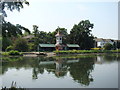
Clocktower in Valentines Park
Taken looking west-southwest across the lake towards Cranbrook Road.
Image: © Robert Lamb
Taken: 26 Jun 2010
0.04 miles
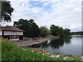
9
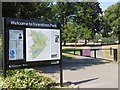
Entrance to Valentines Park
The mansion is believed to have been originally built in 1696-7, though it was largely reconstructed in the 18th century.
The southern part of what is now Valentines Park was declared officially open to the public "for ever" on 16th September 1899 when it was called Central Park. The grand opening was attended by 10,000 people. At this point Central Park extended to just 47 acres. With further purchases the park was gradually extended to its present size of 136 acres and renamed in the early 20th century.
This is one of the entrances from Cranbrook Road. See https://en.wikipedia.org/wiki/Valentines_Park for more information.
Image: © Marathon
Taken: 17 Aug 2016
0.04 miles
10
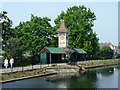
Clock and shelters, Valentines Park
The clock tower is dated 1899.
Image: © Robin Webster
Taken: 24 Apr 2011
0.04 miles