
IMAGES TAKEN NEAR TO
Westbury Road, ILFORD, IG1 3BW
Introduction
This page details the photographs taken nearby to Westbury Road, IG1 3BW by members of the Geograph project.
The Geograph project started in 2005 with the aim of publishing, organising and preserving representative images for every square kilometre of Great Britain, Ireland and the Isle of Man.

There are currently over 7.5m images from over14,400 individuals and you can help contribute to the project by visiting https://www.geograph.org.uk
Image Map
Images are licensed for reuse under creativecommons.org/licenses/by-sa/2.0
Notes
- Clicking on the map will re-center to the selected point.
- The higher the marker number, the further away the image location is from the centre of the postcode.
Image Listing (11 Images Found)
Images are licensed for reuse under creativecommons.org/licenses/by-sa/2.0
Image
Details
Distance
1
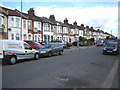
Ilford: Mayfair Avenue
A glance at the map shows nine parallel roads straddling four grid squares here. The roads glory in the names Empress, Mayfair, and Courtland Avenues, followed north-westwards by De Vere, Kensington, Seymour, Sackville, Stanhope and Lennox Gardens. The house building styles are very similar on each road, and the only feature that distinguishes the estate from any other is the comparatively large width of the roads.
Image: © Nigel Cox
Taken: 2 Sep 2007
0.10 miles
2
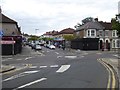
Junction of Belgrave Road and Northbrook Road, Ilford
A small cluster of shops serving this residential area
Image: © David Smith
Taken: 8 Aug 2016
0.11 miles
3
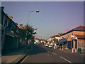
Belgrave Road, Ilford
Belgrave Road is a small shopping street off Northbrook Road, mostly containing supermarkets and charity shops. View taken looking west-northwest.
Image: © Robert Lamb
Taken: 12 Oct 2008
0.12 miles
4
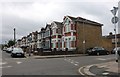
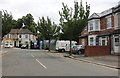
Belgrave Road at the junction of Mayfair Avenue
Image: © David Howard
Taken: 6 Jun 2020
0.13 miles
5
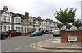
Wanstead Park Road at the corner of Mayfair Avenue
Image: © David Howard
Taken: 6 Jun 2020
0.13 miles
7
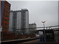
View of Mill House from Ilford Station
Mill House is BT's office block. Looking west-southwest from Ilford station.
Image: © Robert Lamb
Taken: 20 Feb 2011
0.21 miles
8
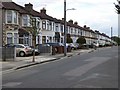
Belgrave Road, Ilford
Terrace of houses, most of which have had alterations to their facades
Image: © David Smith
Taken: 8 Aug 2016
0.21 miles
9
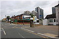
York Road, Ilford
At the junction of Mill Road
Image: © David Howard
Taken: 6 Jun 2020
0.22 miles
10
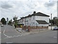
Mansfield Road, Ilford
On the corner is a children's nursery
Image: © David Smith
Taken: 9 Aug 2016
0.23 miles