
IMAGES TAKEN NEAR TO
Winston Way, ILFORD, IG1 2ZD
Introduction
This page details the photographs taken nearby to Winston Way, IG1 2ZD by members of the Geograph project.
The Geograph project started in 2005 with the aim of publishing, organising and preserving representative images for every square kilometre of Great Britain, Ireland and the Isle of Man.

There are currently over 7.5m images from over14,400 individuals and you can help contribute to the project by visiting https://www.geograph.org.uk
Image Map
Images are licensed for reuse under creativecommons.org/licenses/by-sa/2.0
Notes
- Clicking on the map will re-center to the selected point.
- The higher the marker number, the further away the image location is from the centre of the postcode.
Image Listing (170 Images Found)
Images are licensed for reuse under creativecommons.org/licenses/by-sa/2.0
Image
Details
Distance
1
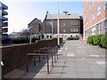
From corner of Chadwick Road, Ilford IG1
Image: © John Salmon
Taken: 9 Apr 2007
0.01 miles
2

Poineer Point, Ilford
As seen along Chapel Road. Pioneer Point is a new block of flats constructed in Ilford, on the former site of the Pioneer covered market.
Image: © David Anstiss
Taken: 31 Mar 2013
0.01 miles
3
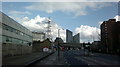
View of Pioneer Point from Romford Road #3
Looking north-northeast. The building at the extreme left of the photograph used to be a Renault dealer but is now empty.
Image: © Robert Lamb
Taken: 26 Feb 2014
0.02 miles

5
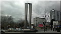
View of Pioneer's Gate from Winston Way
This 24ft sculpture was unveiled in late 2012 to fit in with the design of Pioneer Point, behind the camera. It is made of nine “reciprocally linked rectangular steel frames which nest and intersect each other” and takes on a different appearance, depending on which angle you're standing. If one stands on the central reservation, it forms a spiral, but from this angle it is more of an arch shape. See http://www.ilfordrecorder.co.uk/news/news/inspiring_24ft_sculpture_unveiled_in_ilford_as_pioneer_point_towers_completed_1_1717164?usurv=completed. Looking north-northwest.
Image: © Robert Lamb
Taken: 4 Mar 2014
0.02 miles
6

View of Pioneer Point from Mildmay Road
Looking west.
Image: © Robert Lamb
Taken: 7 Feb 2014
0.02 miles
7
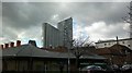
View of Pioneer Point and the Albert Road Children's Centre from Albert Road
Looking north-northwest across Cleveland Road.
Image: © Robert Lamb
Taken: 7 Feb 2014
0.02 miles
8

Sainsbury Ilford East London
Iconic Sainsbury in Ilford East London set to close and be demolished in place of 1,000 homes.
It has been serving the local community for over 30 years.
Image: © Gita Patel
Taken: 26 Dec 2021
0.02 miles
9
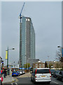
Pioneer Point nears completion
Structurally at its full height, the nearer block of two nearly hides the other block from this angle - it is just visible on the left. They will be flats, but probably called apartments.
Image: © Robin Webster
Taken: 2 Apr 2011
0.02 miles
10
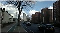
View of Pioneer Point from Romford Road
Looking north-northeast back towards Ilford.
Image: © Robert Lamb
Taken: 26 Feb 2014
0.02 miles