IMAGES TAKEN NEAR TO
Bluebell Way, ILFORD, IG1 2GZ
Introduction
This page details the photographs taken nearby to Bluebell Way, IG1 2GZ by members of the Geograph project.
The Geograph project started in 2005 with the aim of publishing, organising and preserving representative images for every square kilometre of Great Britain, Ireland and the Isle of Man.

There are currently over 7.5m images from over14,400 individuals and you can help contribute to the project by visiting https://www.geograph.org.uk
Image Map
Images are licensed for reuse under creativecommons.org/licenses/by-sa/2.0
Notes
- Clicking on the map will re-center to the selected point.
- The higher the marker number, the further away the image location is from the centre of the postcode.
Image Listing (49 Images Found)
Images are licensed for reuse under creativecommons.org/licenses/by-sa/2.0
Image
Details
Distance
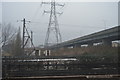
1
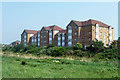
Flats, Barking
Overlooking the River Roding which is hidden below the bushes.
Image: © Robin Webster
Taken: 24 Apr 2011
0.00 miles
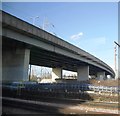
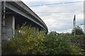
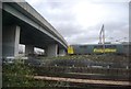
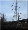
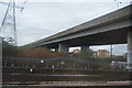
2
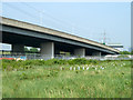
Viaduct on North Circular Road
The A406 along the Roding valley is ramping up to cross railway lines off to the left.
Image: © Robin Webster
Taken: 24 Apr 2011
0.06 miles