IMAGES TAKEN NEAR TO
Salisbury Avenue, BARKING, IG11 9XX
Introduction
This page details the photographs taken nearby to Salisbury Avenue, IG11 9XX by members of the Geograph project.
The Geograph project started in 2005 with the aim of publishing, organising and preserving representative images for every square kilometre of Great Britain, Ireland and the Isle of Man.

There are currently over 7.5m images from over14,400 individuals and you can help contribute to the project by visiting https://www.geograph.org.uk
Image Map
Images are licensed for reuse under creativecommons.org/licenses/by-sa/2.0
Notes
- Clicking on the map will re-center to the selected point.
- The higher the marker number, the further away the image location is from the centre of the postcode.
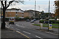
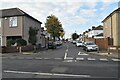
Image Listing (46 Images Found)
Images are licensed for reuse under creativecommons.org/licenses/by-sa/2.0
Image
Details
Distance
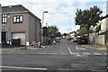
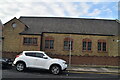
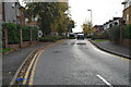
6
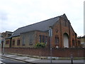
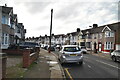
Barking United Reformed Church
On the junction of Salisbury Avenue (on the left) and Upney Lane.
Image: © David Anstiss
Taken: 31 Mar 2013
0.10 miles
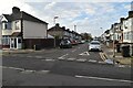
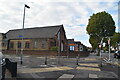
8
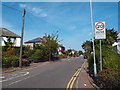
Sandringham Road, near Barking
Sandringham Road is a residential road near Barking, in east London's outer suburbs.
Image: © Malc McDonald
Taken: 28 Aug 2017
0.12 miles