
IMAGES TAKEN NEAR TO
Cornwall Close, BARKING, IG11 9JF
Introduction
This page details the photographs taken nearby to Cornwall Close, IG11 9JF by members of the Geograph project.
The Geograph project started in 2005 with the aim of publishing, organising and preserving representative images for every square kilometre of Great Britain, Ireland and the Isle of Man.

There are currently over 7.5m images from over14,400 individuals and you can help contribute to the project by visiting https://www.geograph.org.uk
Image Map
Images are licensed for reuse under creativecommons.org/licenses/by-sa/2.0
Notes
- Clicking on the map will re-center to the selected point.
- The higher the marker number, the further away the image location is from the centre of the postcode.
Image Listing (62 Images Found)
Images are licensed for reuse under creativecommons.org/licenses/by-sa/2.0
Image
Details
Distance
1
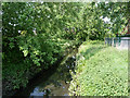
Mayes Brook
Running along the western edge of Mayesbrook Park.
Image: © Robin Webster
Taken: 24 Apr 2011
0.06 miles
2
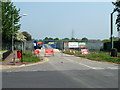
Site entrance to Mayesbrook Park
Some sort of work in the park has required a temporary bridge for heavy vehicles to be built over the top of the permanent bridge across the Mayes Brook.
Image: © Robin Webster
Taken: 24 Apr 2011
0.07 miles
3
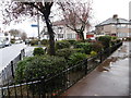
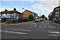
Looking along The Drive, Upney
Taken on a very wet day, this view looks along The Drive, past the junction on the right with Oakley Avenue.
Image: © Marathon
Taken: 9 Mar 2016
0.07 miles
4
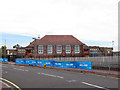
Manor Junior School - main building, south end
A view from Stratton Drive. The blue banners are for the Barking Skyride that was taking place the same day.
Image: © Stephen Craven
Taken: 21 Aug 2011
0.10 miles
6
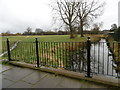
Mayes Brook in Mayesbrook Park
Mayesbrook Park was first opened in 1934 during the growth of the Becontree Estate and was formed by enclosing land that was previously open countryside. The two lakes were created when gravel was extracted for use in building the Estate. The lakes are known locally as 'Matchstick Island' and more formally, if uninspiringly, as North Lake and South Lake.
The park was originally designed by the Landscape Architect Thomas Mawson but his plans were never fully realised as the Second World War intervened. Construction stopped and the park was used for temporary army accommodation.
In 2011 the park was significantly altered by widening the Mayes Brook, which followed the western edge of the park, and moving it to meander through the park. This is the Mayes Brook where it follows its previous course. It is further upstream where it has been changed. This view looks downstream near the entrance from The Drive. The Mayes Brook eventually flows into the River Roding.
Image: © Marathon
Taken: 9 Mar 2016
0.11 miles
7
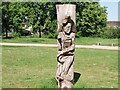
View of a wood carving of a runner in Mayesbrook Park
Looking south-southwest.
Image: © Robert Lamb
Taken: 1 Jun 2021
0.11 miles
8
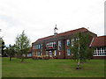
Manor Junior School - main building
This is quite an impressive building for a junior school. It is also pleasing and rare nowadays to see a school without high security fencing round it. The access ramp with its yellow handrails has obviously been added later.
Image: © Stephen Craven
Taken: 21 Aug 2011
0.13 miles
9
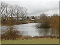
North Lake, Mayesbrook Park
Mayesbrook Park was first opened in 1934 during the growth of the Becontree Estate and was formed by enclosing land that was previously open countryside. The two lakes were created when gravel was extracted for use in building the Estate. The lakes are known locally as 'Matchstick Island' and more formally, if uninspiringly, as North Lake and South Lake.
The park was originally designed by the Landscape Architect Thomas Mawson but his plans were never fully realised as the Second World War intervened. Construction stopped and the park was used for temporary army accommodation.
In 2011 the park was significantly altered by widening the Mayes Brook, which followed the western edge of the park, and moving it to meander through the park. Its course is on this side of the houses in the distance.
Image: © Marathon
Taken: 9 Mar 2016
0.13 miles
10
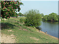
In Mayesbrook Park
The pond and another nearby were probably gravel diggings of the 1930s, which were soon annexed to the existing Mayesbrook Park to the north.
Image: © Robin Webster
Taken: 24 Apr 2011
0.13 miles