
IMAGES TAKEN NEAR TO
Dereham Road, BARKING, IG11 9HA
Introduction
This page details the photographs taken nearby to Dereham Road, IG11 9HA by members of the Geograph project.
The Geograph project started in 2005 with the aim of publishing, organising and preserving representative images for every square kilometre of Great Britain, Ireland and the Isle of Man.

There are currently over 7.5m images from over14,400 individuals and you can help contribute to the project by visiting https://www.geograph.org.uk
Image Map
Images are licensed for reuse under creativecommons.org/licenses/by-sa/2.0
Notes
- Clicking on the map will re-center to the selected point.
- The higher the marker number, the further away the image location is from the centre of the postcode.
Image Listing (16 Images Found)
Images are licensed for reuse under creativecommons.org/licenses/by-sa/2.0
Image
Details
Distance
1
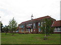
Manor Junior School - main building
This is quite an impressive building for a junior school. It is also pleasing and rare nowadays to see a school without high security fencing round it. The access ramp with its yellow handrails has obviously been added later.
Image: © Stephen Craven
Taken: 21 Aug 2011
0.12 miles
2
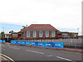
Manor Junior School - main building, south end
A view from Stratton Drive. The blue banners are for the Barking Skyride that was taking place the same day.
Image: © Stephen Craven
Taken: 21 Aug 2011
0.15 miles
3
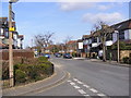
Sandringham Road, Barking
Looking towards Manor School at the junction with Beccles Drive
Image: © Geographer
Taken: 17 Mar 2009
0.17 miles
4
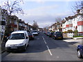
Beccles Drive, Barking
At the junction with Sandringham Road
Image: © Geographer
Taken: 17 Mar 2009
0.17 miles
5
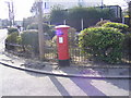
Sandringham Road George V Postbox in Beccles Drive
At the junction with Sandringham Road
Postbox No.IG11 28
Image: © Geographer
Taken: 17 Mar 2009
0.18 miles
6
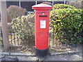
Sandringham Road George V Postbox in Beccles Drive
At the junction with Sandringham Road
Postbox No.IG11 28
Image: © Geographer
Taken: 17 Mar 2009
0.18 miles
7
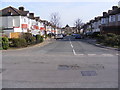
Beccles Drive, Barking
At the junction with Sandringham Road
Image: © Geographer
Taken: 17 Mar 2009
0.18 miles
8
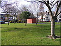
Electricity-Sub Station in Cavendish Gardens, Barking
At the junction with Stratton Drive
Image: © Geographer
Taken: 17 Mar 2009
0.21 miles
9
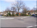
Electricity Sub-Station in Cavendish Gardens, Barking
At the roundabout junction Cavendish Gardens and Stratton Drive
Image: © Geographer
Taken: 17 Mar 2009
0.21 miles
10

The Mayes Brook in Mayesbrook Park
This stream was re-aligned in 2011 to create a better wildlife habitat in the park and to create wetlands either side of the stream.
Image: © David Anstiss
Taken: 31 Mar 2013
0.22 miles