
IMAGES TAKEN NEAR TO
North Street, BARKING, IG11 8AW
Introduction
This page details the photographs taken nearby to North Street, IG11 8AW by members of the Geograph project.
The Geograph project started in 2005 with the aim of publishing, organising and preserving representative images for every square kilometre of Great Britain, Ireland and the Isle of Man.

There are currently over 7.5m images from over14,400 individuals and you can help contribute to the project by visiting https://www.geograph.org.uk
Image Map
Images are licensed for reuse under creativecommons.org/licenses/by-sa/2.0
Notes
- Clicking on the map will re-center to the selected point.
- The higher the marker number, the further away the image location is from the centre of the postcode.
Image Listing (224 Images Found)
Images are licensed for reuse under creativecommons.org/licenses/by-sa/2.0
Image
Details
Distance
1

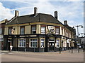
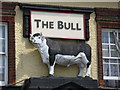
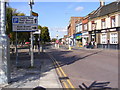
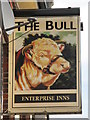
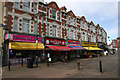
The Bull Public House, Barking
Disused public house on the junction of North Street (on the left) and East Street.
Image: © David Anstiss
Taken: 16 Dec 2012
0.02 miles
8
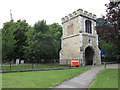
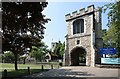
Barking Curfew Tower
Part of the long-lost Abbey, this tower was constructed in 1460.
It is listed grade 2* (under the name "fire bell gate" which is what Curfew means), List Entry Number 1064407.
Image: © Stephen Craven
Taken: 21 Aug 2011
0.05 miles
9
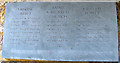
Barking Curfew Tower: plaque
This plaque within the ground floor of the tower gives the history of the tower, church and former Abbey. It was unveiled in 1960 on the 500th anniversary of the tower.
See Image for context.
Image: © Stephen Craven
Taken: 21 Aug 2011
0.05 miles
10
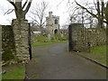
The Curfew Tower, Barking
Barking Abbey was founded in AD 666 by a monk called Erkenwald, later a saint and Bishop of the East Saxons, for his sister Ethelburga and dedicated to St Mary. The first Abbey was a double house containing both monks and nuns but under the control of an Abbess. The Abbey was destroyed by Vikings in AD 871 and restored about a century later as a single-sex Benedictine nunnery under the patronage of the Kings of Wessex and England. By 1066 it was large enough to accommodate the new King, William the Conqueror and his followers. Towards the end of that year many of the Saxon Earls and Lords made their way to Barking to swear allegiance to their new King. In later centuries Royal grants made Barking Abbey the second richest abbey in the country with estates in Essex, Middlesex, London and Surrey.
The abbey was surrendered to the crown in 1539 at the Dissolution of the Monasteries. Demolition began the following year and took 18 months. Stone and lead from this was used at the King's manor house at Dartford and at Greenwich Palace. The North-east Gate and the Curfew Tower remained, but the former was demolished about 1885. The Curfew Tower, which had been rebuilt about 1460 was rededicated in 1894/5 and still spans the eastern entrance to St Margaret's Churchyard. In 1910 the site was acquired by Barking Urban District council and in 1911 the site of the Abbey was excavated. The walls of the Abbey church, cloisters and surrounding buildings were rebuilt in stone and the site was laid out as a park.
St Margaret's Church dates from the 13th century or earlier and was built within the Abbey precincts. It is said to have been a chapel until it was made into the parish church about 1300.
This view looks from near the Abbey site towards the Curfew Tower, past St Margaret's Churchyard - see http://www.geograph.org.uk/photo/4860958
Image: © Marathon
Taken: 9 Mar 2016
0.05 miles