
IMAGES TAKEN NEAR TO
Spring Place, BARKING, IG11 7GL
Introduction
This page details the photographs taken nearby to Spring Place, IG11 7GL by members of the Geograph project.
The Geograph project started in 2005 with the aim of publishing, organising and preserving representative images for every square kilometre of Great Britain, Ireland and the Isle of Man.

There are currently over 7.5m images from over14,400 individuals and you can help contribute to the project by visiting https://www.geograph.org.uk
Image Map
Images are licensed for reuse under creativecommons.org/licenses/by-sa/2.0
Notes
- Clicking on the map will re-center to the selected point.
- The higher the marker number, the further away the image location is from the centre of the postcode.
Image Listing (29 Images Found)
Images are licensed for reuse under creativecommons.org/licenses/by-sa/2.0
Image
Details
Distance
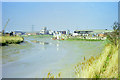
2
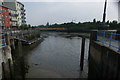
View along the Roding towards Creekmouth from the lock near Barking
Looking south-southeast.
Image: © Robert Lamb
Taken: 6 May 2017
0.06 miles
3
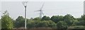
View of a wind turbine and pylon at Beckton from Hand Trough Creek
Looking south-southeast.
Image: © Robert Lamb
Taken: 6 May 2017
0.07 miles
4

View of a bridge over the lock at Town Quay
Looking north-northeast.
Image: © Robert Lamb
Taken: 6 May 2017
0.07 miles
6

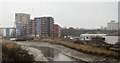
Roding Navigation weir from Cuckold's Haven, Barking Creek
Weir and tidal gates (not a pound lock but a lock that operates at high tide), with marina & boats
Image: © David Sankey
Taken: 11 Sep 2022
0.07 miles
7
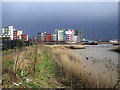
Barking: Gladedale Development on Abbey Road
This is the new Gladedale housing development in Abbey Road, viewed looking across the Barking Creek reach of the River Roding, with Hand Trough Creek to the right. There is a floating crane to the right of the development. The photo was taken just after a squall had passed by, hence the dark skies in the distance.
Image: © Nigel Cox
Taken: 28 Feb 2007
0.09 miles

9

View of boats moored on the Roding at Town Quay #6
Looking north-northwest.
Image: © Robert Lamb
Taken: 6 May 2017
0.09 miles
10
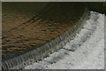
View of a weir at Hand Trough Creek
Looking south-southeast.
Image: © Robert Lamb
Taken: 6 May 2017
0.09 miles