
IMAGES TAKEN NEAR TO
Wivenhoe Road, BARKING, IG11 0RE
Introduction
This page details the photographs taken nearby to Wivenhoe Road, IG11 0RE by members of the Geograph project.
The Geograph project started in 2005 with the aim of publishing, organising and preserving representative images for every square kilometre of Great Britain, Ireland and the Isle of Man.

There are currently over 7.5m images from over14,400 individuals and you can help contribute to the project by visiting https://www.geograph.org.uk
Image Map
Images are licensed for reuse under creativecommons.org/licenses/by-sa/2.0
Notes
- Clicking on the map will re-center to the selected point.
- The higher the marker number, the further away the image location is from the centre of the postcode.
Image Listing (21 Images Found)
Images are licensed for reuse under creativecommons.org/licenses/by-sa/2.0
Image
Details
Distance
5
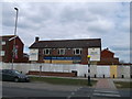
The Short Blue Public house, Thames View
This closed pub is on the junction of Bastable Avenue (in front) and Endeaver Way.
Image: © David Anstiss
Taken: 31 Mar 2013
0.15 miles
9
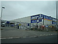
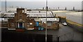
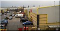
New Jewson's Store on A13 Ripple Road
This new Jewson store was only built last year, replacing a plumbing store and a Big Yellow Self Storage unit. This is the only Jewson's store I know of in this neck of the woods - there was one near where I live, but this was replaced by Toys R Us and Currys stores in the mid-1990s. View taken from the A13 off-slip onto Ripple Road looking west/north-west.
Image: © Robert Lamb
Taken: 14 Dec 2008
0.20 miles
10
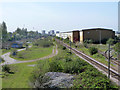
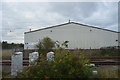
Railway west of Renwick Road bridge
The up and down passenger tracks are on the left and right, between them the area formerly occupied by the reception sidings for Ripple lane marshalling yard, behind the viewpoint. After closure of the yard and general contraction of freight using this route, the tracks here have been much simplified. The spur leading right is to a stone terminal.
Image: © Robin Webster
Taken: 9 Apr 2011
0.20 miles