
IMAGES TAKEN NEAR TO
Marine Drive, BARKING, IG11 0GJ
Introduction
This page details the photographs taken nearby to Marine Drive, IG11 0GJ by members of the Geograph project.
The Geograph project started in 2005 with the aim of publishing, organising and preserving representative images for every square kilometre of Great Britain, Ireland and the Isle of Man.

There are currently over 7.5m images from over14,400 individuals and you can help contribute to the project by visiting https://www.geograph.org.uk
Image Map
Images are licensed for reuse under creativecommons.org/licenses/by-sa/2.0
Notes
- Clicking on the map will re-center to the selected point.
- The higher the marker number, the further away the image location is from the centre of the postcode.
Image Listing (14 Images Found)
Images are licensed for reuse under creativecommons.org/licenses/by-sa/2.0
Image
Details
Distance
1
Barking Riverside
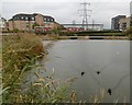
Barking Riverside is a huge new 11,000 home development on the old Barking Levels. The land was originally grazing marshes consisting of flat, low-lying grasslands, dissected by ditches and it survived in this form until the 1920s. Much of this has now gone although a few of the ditches have been incorporated into the new development as seen here. In the distance is the bus terminus at Marine Drive
An interesting article about Barking Riverside can be seen at https://www.theguardian.com/cities/2015/aug/17/no-cafe-pub-doctor-londons-most-isolated-suburb-barking-riverside
Image: © Marathon
Taken: 9 Nov 2016
0.08 miles
2
Barking Riverside
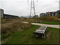
Barking Riverside is a huge new 11,000 home development on the old Barking Levels. The land was originally grazing marshes consisting of flat, low-lying grasslands, dissected by ditches and it survived in this form until the 1920s. Much of this has now gone although a few of the ditches have been incorporated into the new development. That is probably the best thing about the development as the 'architecture' is, to be kind, nondescript.
An interesting article about Barking Riverside can be seen at https://www.theguardian.com/cities/2015/aug/17/no-cafe-pub-doctor-londons-most-isolated-suburb-barking-riverside
Image: © Marathon
Taken: 9 Nov 2016
0.15 miles
3
New electricity installation
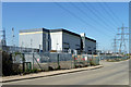
Although mapped simply as a substation, this is clearly a rather special one. All very high voltage, gently sizzling in the sun (not that the sun has anything to do with it).
Image: © Robin Webster
Taken: 9 Apr 2011
0.22 miles
4
Power Station at Barking Riverside
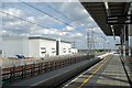
There seems to be a lot of electricity around here. Power installations, pylons, cables in all directions. Some of the industry may have gone, but big housing developments are going up all around so there will be new customers.
Image: © Des Blenkinsopp
Taken: 29 Apr 2024
0.22 miles
5
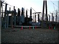
Creekmouth Substation
This is just a small section of the electrical substation at Creekmouth
Image: © Glyn Baker
Taken: 8 Sep 2005
0.22 miles
6
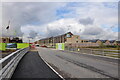
Construction of City East development at Barking Riverside
Photo taken from bridge on Galleons Drive, Barking Riverside. New terraced properties, built by Bellway, are pictured nearing completion.
Image: © Charence Wong
Taken: 13 Oct 2012
0.23 miles
7
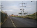
Creekmouth: Renwick Road
The pylons carry high voltage electricity cables to and from the National Grid's Barking Sub-Station, which is on the left side of the road.
Image: © Nigel Cox
Taken: 26 Jan 2007
0.23 miles
8
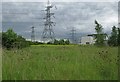
Across The Ripple Reserve
The Ripple is a former ash dump form the now demolished Barkingside Power Station.
The kit in the background is Creekmouth Substation. Nature has reclaimed this industrial wasteland and it is now a Nature Reserve managed by The London Wildlife Trust to find out more see http://www.wildlondon.org.uk/Naturereserves/TheRipple/tabid/141/Default.aspx
Image: © Glyn Baker
Taken: 20 Jun 2009
0.23 miles
9
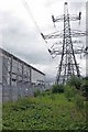
Power & Plants
The plants are in Image Nature Reserve and the buildings are Image Nature has reclaimed this industrial wasteland and it is now a Nature Reserve managed by The London Wildlife Trust to find out more see http://www.wildlondon.org.uk/Naturereserves/TheRipple/tabid/141/Default.aspx
Image: © Glyn Baker
Taken: 20 Jun 2009
0.23 miles
10
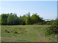
The Ripple Nature Reserve
Waste ground off Renwick Road.
Image: © Robin Webster
Taken: 9 Apr 2011
0.23 miles