
IMAGES TAKEN NEAR TO
Smarts Lane, LOUGHTON, IG10 4BW
Introduction
This page details the photographs taken nearby to Smarts Lane, IG10 4BW by members of the Geograph project.
The Geograph project started in 2005 with the aim of publishing, organising and preserving representative images for every square kilometre of Great Britain, Ireland and the Isle of Man.

There are currently over 7.5m images from over14,400 individuals and you can help contribute to the project by visiting https://www.geograph.org.uk
Image Map
Images are licensed for reuse under creativecommons.org/licenses/by-sa/2.0
Notes
- Clicking on the map will re-center to the selected point.
- The higher the marker number, the further away the image location is from the centre of the postcode.
Image Listing (70 Images Found)
Images are licensed for reuse under creativecommons.org/licenses/by-sa/2.0
Image
Details
Distance
1
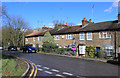
Upper Bellevue Cottages, Smarts Lane
The name is on the wall plaque in the centre of the picture.
Image: © Des Blenkinsopp
Taken: 14 Mar 2019
0.01 miles
4
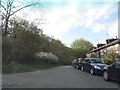
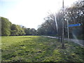
Nursery Road, Loughton
The roads on the right drop down to the centre of Loughton. On the left is Epping Forest including Strawberry Hill.
Epping Forest was once a large expanse of broad-leaved woodland covering much of the eastern flank of the River Lea and stretching from the flood plains of the Lea into Essex. There were great threats to the Forest in the 19th century with proposed enclosures and sale of parts of the Forest. In August 1871 the City of London Corporation stepped in as a commoner with grazing rights and brought an action against the lords of the manor which lasted over three years. The manorial lords claimed that each manor was separate and that the commoners of that manor had no rights over the rest of the Forest. They said that if a manor satisfied its own commoners it could legally enclose that manor. The Corporation disputed this and claimed that commoners' rights extended throughout the whole Forest. Final judgement was given to the Corporation and following this the Corporation systematically bought all the remaining 'waste' land of the Forest and through the Epping Forest Act of 1878 became Conservators of Epping Forest. Epping Forest was formally opened on 6th May 1882 at High Beach when Queen Victoria dedicated "this beautiful Forest to the enjoyment of my people for ever."
Image: © Marathon
Taken: 7 Feb 2017
0.03 miles
6
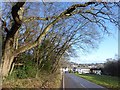
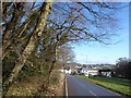
Looking down Nursery Road
The roads on the right drop down to the centre of Loughton. On the left is Epping Forest including Strawberry Hill.
Epping Forest was once a large expanse of broad-leaved woodland covering much of the eastern flank of the River Lea and stretching from the flood plains of the Lea into Essex. There were great threats to the Forest in the 19th century with proposed enclosures and sale of parts of the Forest. In August 1871 the City of London Corporation stepped in as a commoner with grazing rights and brought an action against the lords of the manor which lasted over three years. The manorial lords claimed that each manor was separate and that the commoners of that manor had no rights over the rest of the Forest. They said that if a manor satisfied its own commoners it could legally enclose that manor. The Corporation disputed this and claimed that commoners' rights extended throughout the whole Forest. Final judgement was given to the Corporation and following this the Corporation systematically bought all the remaining 'waste' land of the Forest and through the Epping Forest Act of 1878 became Conservators of Epping Forest. Epping Forest was formally opened on 6th May 1882 at High Beach when Queen Victoria dedicated "this beautiful Forest to the enjoyment of my people for ever."
Image: © Marathon
Taken: 7 Feb 2017
0.05 miles
8
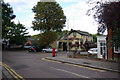
High Beech Road, Loughton
Showing the junction between High Beech Road and Smart's Lane as well as the Victoria - one of Loughton's best loved pubs.
Image: © Stephen McKay
Taken: 4 Oct 2009
0.05 miles
9
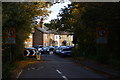
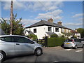
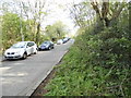
Forest Road, Loughton, Essex
Looking down Forest Road, from the edge of Epping Forest. The houses, in the centre of picture, are mid Victorian. Those to the left of picture are more recent.
Image: © Peter Trimming
Taken: 6 Nov 2010
0.05 miles
10
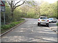
Smart's Lane at the junction of Earl's Path
On the edge of Epping Forest
Image: © David Howard
Taken: 9 Apr 2014
0.06 miles