
IMAGES TAKEN NEAR TO
Edward Street, HEBDEN BRIDGE, HX7 8DF
Introduction
This page details the photographs taken nearby to Edward Street, HX7 8DF by members of the Geograph project.
The Geograph project started in 2005 with the aim of publishing, organising and preserving representative images for every square kilometre of Great Britain, Ireland and the Isle of Man.

There are currently over 7.5m images from over14,400 individuals and you can help contribute to the project by visiting https://www.geograph.org.uk
Image Map
Images are licensed for reuse under creativecommons.org/licenses/by-sa/2.0
Notes
- Clicking on the map will re-center to the selected point.
- The higher the marker number, the further away the image location is from the centre of the postcode.
Image Listing (519 Images Found)
Images are licensed for reuse under creativecommons.org/licenses/by-sa/2.0
Image
Details
Distance
2
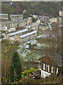
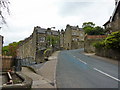
Housing and industry, Hebden Bridge
The street at the centre of this view is Victoria Road, located at SD 990 278. Above it can be seen examples of Hebden Bridge famous double decker houses. The lack of flat land, and the desire to squeeze as many houses in as possible led to the construction of these unique properties. These consist of two properties stacked on top of each other - an 'underdwelling' accessed from the bottom, and an 'overdwelling' accessed from the street above.
Image: © Phil Champion
Taken: 26 Jan 2006
0.00 miles
4

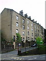
Birch View, Eiffel Street
There is an Ordnance Survey benchmark Image at the middle of the house's roadside face
Image: © Roger Templeman
Taken: 12 Aug 2017
0.02 miles
6
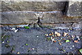
Benchmark on wall fronting Nutclough Cottage
Ordnance Survey cut mark benchmark described on the Bench Mark Database at www.bench-marks.org.uk/bm70180
Image: © Roger Templeman
Taken: 12 Aug 2017
0.02 miles
8
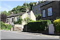
Keighley Road opposite #13
There is an Ordnance Survey benchmark Image on the wall at pavement level near the lamppost
Image: © Roger Templeman
Taken: 12 Aug 2017
0.02 miles

10
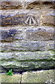
Benchmark on Birch View, Eiffel Street
Ordnance Survey cut mark benchmark described on the Bench Mark Database at www.bench-marks.org.uk/bm87433
Image: © Roger Templeman
Taken: 12 Aug 2017
0.02 miles