IMAGES TAKEN NEAR TO
Eaglescliffe, SOWERBY BRIDGE, HX6 2FN
Introduction
This page details the photographs taken nearby to Eaglescliffe, HX6 2FN by members of the Geograph project.
The Geograph project started in 2005 with the aim of publishing, organising and preserving representative images for every square kilometre of Great Britain, Ireland and the Isle of Man.

There are currently over 7.5m images from over14,400 individuals and you can help contribute to the project by visiting https://www.geograph.org.uk
Image Map
Images are licensed for reuse under creativecommons.org/licenses/by-sa/2.0
Notes
- Clicking on the map will re-center to the selected point.
- The higher the marker number, the further away the image location is from the centre of the postcode.
Image Listing (425 Images Found)
Images are licensed for reuse under creativecommons.org/licenses/by-sa/2.0
Image
Details
Distance
1
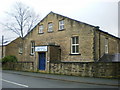
Beechroyd Chapel of Rest, Beech Road
Image: © Alexander P Kapp
Taken: 8 Dec 2008
0.02 miles
2
St Paul's Methodist Church - Tower Hill
Image: © Betty Longbottom
Taken: 30 May 2008
0.02 miles
3
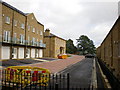
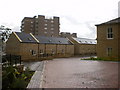
Eaglescliffe
New housing off Beech Street
Image: © Alexander P Kapp
Taken: 3 Sep 2009
0.02 miles
5
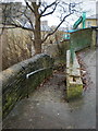
Rose Hill
A steep footpath connecting Beech Road and Tuel Lane
Image: © Alexander P Kapp
Taken: 8 Dec 2008
0.02 miles
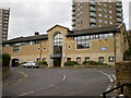
8
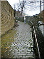
Rose Hill
A steep footpath connecting Beech Road and Tuel Lane
Image: © Alexander P Kapp
Taken: 8 Dec 2008
0.03 miles
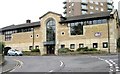
9
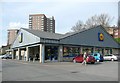
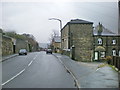
Lidl, Sowerby Bridge
Well-placed on a densely populated hillside.
Image: © Humphrey Bolton
Taken: 5 Mar 2009
0.05 miles
10
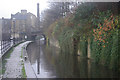
Rochdale Canal, Sowerby Bridge
The wet conditions have muted the colours in this view of the Rochdale Canal, which runs for 32 miles across the Pennines between Sowerby Bridge and Manchester. The canal was originally opened at the end of the 18th century, but was finally abandoned in 1952 after a long decline in traffic. That was not the end, however, because the canal was restored and reopened throughout in 2002.
Image: © Stephen McKay
Taken: 6 Dec 2007
0.06 miles