Rochdale Canal, Sowerby Bridge
Introduction
The photograph on this page of Rochdale Canal, Sowerby Bridge by Stephen McKay as part of the Geograph project.
The Geograph project started in 2005 with the aim of publishing, organising and preserving representative images for every square kilometre of Great Britain, Ireland and the Isle of Man.

There are currently over 7.5m images from over 14,400 individuals and you can help contribute to the project by visiting https://www.geograph.org.uk
Rochdale Canal, Sowerby Bridge
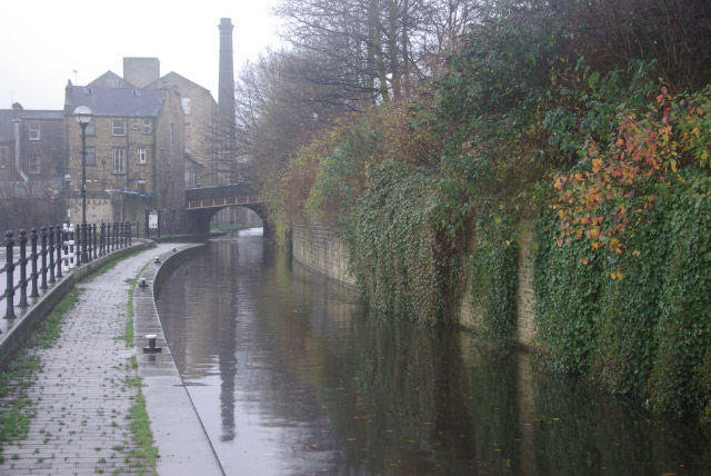
Image: © Stephen McKay Taken: 6 Dec 2007
The wet conditions have muted the colours in this view of the Rochdale Canal, which runs for 32 miles across the Pennines between Sowerby Bridge and Manchester. The canal was originally opened at the end of the 18th century, but was finally abandoned in 1952 after a long decline in traffic. That was not the end, however, because the canal was restored and reopened throughout in 2002.
Images are licensed for reuse under creativecommons.org/licenses/by-sa/2.0
Image Location
Latitude
53.7096
Longitude
-1.910426