IMAGES TAKEN NEAR TO
Fore Lane, SOWERBY BRIDGE, HX6 1AE
Introduction
This page details the photographs taken nearby to Fore Lane, HX6 1AE by members of the Geograph project.
The Geograph project started in 2005 with the aim of publishing, organising and preserving representative images for every square kilometre of Great Britain, Ireland and the Isle of Man.

There are currently over 7.5m images from over14,400 individuals and you can help contribute to the project by visiting https://www.geograph.org.uk
Image Map
Images are licensed for reuse under creativecommons.org/licenses/by-sa/2.0
Notes
- Clicking on the map will re-center to the selected point.
- The higher the marker number, the further away the image location is from the centre of the postcode.
Image Listing (191 Images Found)
Images are licensed for reuse under creativecommons.org/licenses/by-sa/2.0
Image
Details
Distance
1
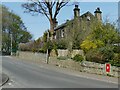
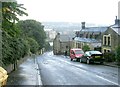
Fore Lane towards Sowerby
This is the continuation of Jerry Lane beyond the milestone Image and is the old road from Elland to Sowerby. Note a postbox in the all to the right.
Image: © Stephen Craven
Taken: 24 Apr 2021
0.01 miles
2
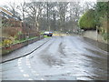
Fore Lane - viewed from Quarry Hill
Image: © Betty Longbottom
Taken: 23 Dec 2014
0.02 miles
3
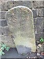
Old milestone
At the top of Jerry Lane at the junction of Quarry Hill and Haugh End Lane is this old stone set against the wall of St George's churchyard. The faint hand pointing left for Elland down Jerry Lane may signify an old route via Greetland not the current main road that is used today. WB Crump, Sowerby Highways, Trans Halifax Antiquarian Society 1928, P12 refers to repairs to this road in the 17C. This stone is Grade II listed 339221
Image: © Robert Glover
Taken: 27 Oct 2020
0.03 miles
5
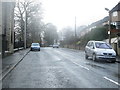
Haugh End Lane - viewed from Quarry Hill
Image: © Betty Longbottom
Taken: 23 Dec 2014
0.03 miles
6
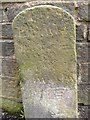
Guide stone at the top of Jerry Lane
This is inscribed: 'Elland 4 M (hand pointing left) Sowerby (hand pointing right). It is interesting in that it shows that Jerry Lane was part of the route from Sowerby to Elland, possibly continuing over Watson Mill Bridge. The route to Halifax via Quarry Hill and Sowerby Bridge is not indicated (unless I missed and inscription on the side of the stone) but is implied by the position of the stone.
Image: © Humphrey Bolton
Taken: 20 May 2013
0.03 miles
7
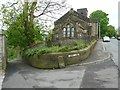
Guide stone at the top of Jerry Lane
See Image for a close view of the stone.
Image: © Humphrey Bolton
Taken: 20 May 2013
0.03 miles
8
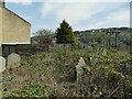
The former St George's church, Sowerby - burial ground
The former churchyard on Haugh End Lane was closed to burials by Order in Council in 1990, shortly after the church itself was closed for worship. It is very overgrown.
Image: © Stephen Craven
Taken: 24 Apr 2021
0.03 miles
9
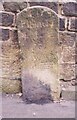
Old Milestone, A6026, Haugh End Lane, Quarry Hill, Sowerby Bridge
W of junction with lane running behind church yard. Located on the West side of road, set against wall of St George's church yard. Carved stone post, 18th century. Alternative views see http://www.geograph.org.uk/photo/6739880 & http://www.geograph.org.uk/photo/6309378
Inscription reads: TO / Elland / 4M {hand to left} / TO / Sowerby / 1M {hand to right}
Grade II listed by Historic England. see https://historicengland.org.uk/listing/the-list/list-entry/1366164
Milestone Society National ID: YW_ELSO04
Image: © Christine Minto
Taken: 30 Dec 2005
0.04 miles