IMAGES TAKEN NEAR TO
Club Lane, HALIFAX, HX2 8DA
Introduction
This page details the photographs taken nearby to Club Lane, HX2 8DA by members of the Geograph project.
The Geograph project started in 2005 with the aim of publishing, organising and preserving representative images for every square kilometre of Great Britain, Ireland and the Isle of Man.

There are currently over 7.5m images from over14,400 individuals and you can help contribute to the project by visiting https://www.geograph.org.uk
Image Map
Images are licensed for reuse under creativecommons.org/licenses/by-sa/2.0
Notes
- Clicking on the map will re-center to the selected point.
- The higher the marker number, the further away the image location is from the centre of the postcode.
Image Listing (69 Images Found)
Images are licensed for reuse under creativecommons.org/licenses/by-sa/2.0
Image
Details
Distance
5
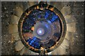
Wheatley tunnel air shaft
At first glance this might look something out of M.C. Escher's portfolio! This is actually an air shaft in the roof of Wheatley tunnel looking up to the world above. Abandoned tunnels usually had the top of the shaft demolished; the shafts were then capped off to stop anyone falling down them. The decking in Wheatley appears to have deteriorated badly, a large hole lets in enough daylight to create this amazing blue glow. A square brick lining has been built around this shaft due to its dangerous nature. The top of this shaft is situated on Cousin Lane and can be seen here http://maps.google.co.uk/maps?f=q&source=s_q&hl=en&geocode=&q=Halifax+cousin+lane+&sll=51.479726,-0.292339&sspn=0.010905,0.027595&ie=UT8&hq=&hnear=Cousin+Ln,+Halifax,+West+Yorkshire+HEX2,+United+Kingdom&ll=53.743145,-1.890094&spn=0.00029,0.002747&t=h&z=19&layer=c&cbll=53.743088,-1.890433&panoid=TV63GMT9g&cbp=12,45.5,,0,3.42 The 819 yard Wheatley tunnel is on the closed Bloomfield to St Paul's line. The Halifax High Level Railway was opened in 1890. The last train along this branch line was in 1960. More information about this railway line can be found here http://www.lostrailwayswestyorkshire.co.uk/Holmfield%20St%20Pauls.htm
Image: © philld
Taken: 28 May 2010
0.10 miles
6
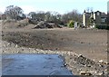
Site of Sykes Mill, Club Lane.Ovenden
It is a good idea to take photographs of mill buildings before they are converted or demolished, but all too often I am too late.
Image: © Humphrey Bolton
Taken: 26 Mar 2009
0.11 miles
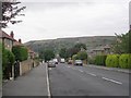
9
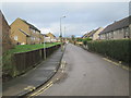
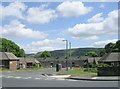
Cumberland Place - looking towards Bank Edge Road
Image: © Betty Longbottom
Taken: 13 Jan 2014
0.14 miles
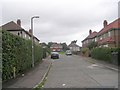
10
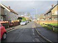
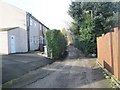
Forest Avenue - looking towards Moor Lane
Image: © Betty Longbottom
Taken: 13 Jan 2014
0.14 miles