IMAGES TAKEN NEAR TO
Far Lane, HALIFAX, HX2 6US
Introduction
This page details the photographs taken nearby to Far Lane, HX2 6US by members of the Geograph project.
The Geograph project started in 2005 with the aim of publishing, organising and preserving representative images for every square kilometre of Great Britain, Ireland and the Isle of Man.

There are currently over 7.5m images from over14,400 individuals and you can help contribute to the project by visiting https://www.geograph.org.uk
Image Map
Images are licensed for reuse under creativecommons.org/licenses/by-sa/2.0
Notes
- Clicking on the map will re-center to the selected point.
- The higher the marker number, the further away the image location is from the centre of the postcode.
Image Listing (74 Images Found)
Images are licensed for reuse under creativecommons.org/licenses/by-sa/2.0
Image
Details
Distance
1
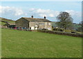
Upper Han Royd, Mytholmroyd
Taken from Far Lane.
Image: © Humphrey Bolton
Taken: 6 Apr 2015
0.01 miles
2
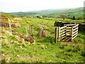
KIssing gate on Sowerby Bridge Footpath 16/3, Midgley
Image: © Humphrey Bolton
Taken: 5 May 2022
0.06 miles
3
Hebden Royd FP35 at Lower Han Royd, Mytholmroyd
The path comes up from the road, in a snicket at first, over the stile, and then turns right.
Image: © Humphrey Bolton
Taken: 17 May 2018
0.07 miles
4
Far lane, Mytholmroyd
Hebden Royd FP21a opposite Lower Han Royd,
Image: © Humphrey Bolton
Taken: 6 Apr 2015
0.07 miles
5
Hebden Royd FP35 leaving Lower Han Royd
The path goes up to a junction at the end of Workhouse Lane.
Image: © Humphrey Bolton
Taken: 17 May 2018
0.08 miles
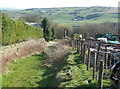
6
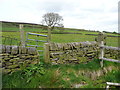
Stile and gate on Hebden Royd FP35, Mytholmroyd
Image: © Humphrey Bolton
Taken: 17 May 2018
0.08 miles
7
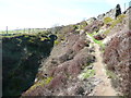
Quarry track, seen from Hebden Royd FP21a
This is not a public footpath, but this is CRoW access land, so you can go up the track from Image] to join FP22 and the Calderdale Way.
Image: © Humphrey Bolton
Taken: 6 Apr 2015
0.08 miles
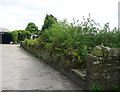
8
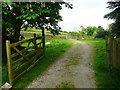
Far Lane, Mytholmroyd
This is the lane looking down it from the gate at the top end.
Image: © Humphrey Bolton
Taken: 8 Jun 2015
0.09 miles
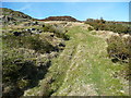
9
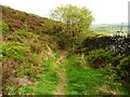
Sowerby Bridge FP17
The deeply sunken track is blocked by brambles and probably rather wet. The path has long since migrated up the bank, next to the wall.
Image: © Humphrey Bolton
Taken: 6 Apr 2015
0.09 miles
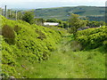
10
Sowerby Bridge Footpath 17/3, Midgley
This path is a sunken track that was probably one of the wagon ways to Foster Clough Delfs.
Image: © Humphrey Bolton
Taken: 5 May 2022
0.09 miles