
IMAGES TAKEN NEAR TO
Savile Park Road, HALIFAX, HX1 2XP
Introduction
This page details the photographs taken nearby to Savile Park Road, HX1 2XP by members of the Geograph project.
The Geograph project started in 2005 with the aim of publishing, organising and preserving representative images for every square kilometre of Great Britain, Ireland and the Isle of Man.

There are currently over 7.5m images from over14,400 individuals and you can help contribute to the project by visiting https://www.geograph.org.uk
Image Map
Images are licensed for reuse under creativecommons.org/licenses/by-sa/2.0
Notes
- Clicking on the map will re-center to the selected point.
- The higher the marker number, the further away the image location is from the centre of the postcode.
Image Listing (140 Images Found)
Images are licensed for reuse under creativecommons.org/licenses/by-sa/2.0
Image
Details
Distance
1
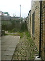
Halifax FP664 off Savile Park Road, Skircoat
Not a very attractive footpath!
Image: © Humphrey Bolton
Taken: 2 Aug 2018
0.01 miles
2
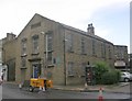
Waterloo Hall - Church of God - Savile Park Road
Image: © Betty Longbottom
Taken: 6 Jul 2009
0.02 miles
3
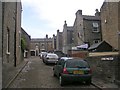
Bell Hall Mount - from Bell Hall Terrace
Image: © Betty Longbottom
Taken: 6 Jul 2009
0.03 miles
4
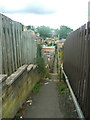
Emscote Street South Footpath, Skircoat, Halifax
This is an adopted path and also Halifax FP664. It has been diverted since it was shown on the 1905 1:2500 map - it used to start further west and curved round to its junction with the short connecting path to Emscote Street.
Image: © Humphrey Bolton
Taken: 2 Aug 2018
0.04 miles
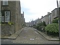
6
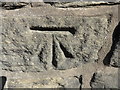
OS Cut Benchmark, Savile Park Road
This can be found on a wall close to the junction with Rothwell Road. Details at https://www.bench-marks.org.uk/bm83355
Image: © Stephen Armstrong
Taken: 24 Sep 2018
0.05 miles
7
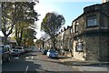
Emscote Street South, Halifax
South is just 'S' on the street map, but at the top of the street a supplementary plate has been added with 'South' on it. However there aren't any more Emscote streets in the street atlas index, and it is plain Emscote Street on the 1905 OS map.
Image: © Humphrey Bolton
Taken: 16 Oct 2008
0.05 miles
8
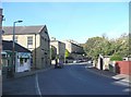
Savile Park Road, Halifax
With the Waterloo Hall on the left.
Image: © Humphrey Bolton
Taken: 16 Oct 2008
0.05 miles
10
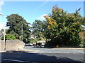
Savile Park Road / Rothwell Road Junction
There is an OS Cut Benchmark Image on the wall just before it curves down Rothwell Road.
Image: © Stephen Armstrong
Taken: 24 Sep 2018
0.05 miles