IMAGES TAKEN NEAR TO
Southcroft Drive, HULL, HU8 9UN
Introduction
This page details the photographs taken nearby to Southcroft Drive, HU8 9UN by members of the Geograph project.
The Geograph project started in 2005 with the aim of publishing, organising and preserving representative images for every square kilometre of Great Britain, Ireland and the Isle of Man.

There are currently over 7.5m images from over14,400 individuals and you can help contribute to the project by visiting https://www.geograph.org.uk
Image Map
Images are licensed for reuse under creativecommons.org/licenses/by-sa/2.0
Notes
- Clicking on the map will re-center to the selected point.
- The higher the marker number, the further away the image location is from the centre of the postcode.
Image Listing (205 Images Found)
Images are licensed for reuse under creativecommons.org/licenses/by-sa/2.0
Image
Details
Distance

2

Filling station, Robson Way, Hull
Clearly not a teeTotal filling station.
Image: © Paul Harrop
Taken: 13 Jan 2008
0.10 miles

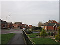
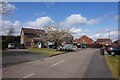
4
Modern houses on a close off Howdale Road, Hull
Image: © JThomas
Taken: 9 Apr 2010
0.11 miles
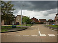
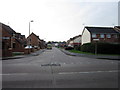
6
Hovingham Close off Howdale Road, Hull
https://www.geograph.org.uk/photo/6828945
Image: © Ian S
Taken: 30 Apr 2021
0.11 miles
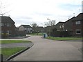
7

Gillamoor Close off Howdale Road, Hull
https://www.geograph.org.uk/photo/6829115
Image: © Ian S
Taken: 30 Apr 2021
0.12 miles