
IMAGES TAKEN NEAR TO
Dalton Street, HULL, HU8 8BB
Introduction
This page details the photographs taken nearby to Dalton Street, HU8 8BB by members of the Geograph project.
The Geograph project started in 2005 with the aim of publishing, organising and preserving representative images for every square kilometre of Great Britain, Ireland and the Isle of Man.

There are currently over 7.5m images from over14,400 individuals and you can help contribute to the project by visiting https://www.geograph.org.uk
Image Map
Images are licensed for reuse under creativecommons.org/licenses/by-sa/2.0
Notes
- Clicking on the map will re-center to the selected point.
- The higher the marker number, the further away the image location is from the centre of the postcode.
Image Listing (203 Images Found)
Images are licensed for reuse under creativecommons.org/licenses/by-sa/2.0
Image
Details
Distance
1

Glass House Row, Kingston upon Hull
The tower of the former Anglo-American Oil Mill, Glass House Row, now demolished.
See also: Image
The history of the origin of Glass House Row may be found here http://www.hullcc.gov.uk/museumcollections/collections/storydetail.php?irn=873
Image: © Bernard Sharp
Taken: 13 May 1984
0.06 miles
2

Glass House Row, Kingston upon Hull
Detail of the tower of the former Anglo-American Oil Mill, Glass House Row, now demolished.
See also: Image
The history of the origin of Glass House Row may be found here http://www.hullcc.gov.uk/museumcollections/collections/storydetail.php?irn=873
Image: © Bernard Sharp
Taken: 13 May 1984
0.06 miles
3

Glass House Row, Kingston upon Hull
The remaining buildings of the former Anglo-American Oil Mill, Glass House Row, as seen from Sculcoates Bridge, Chapman Street. The buildings on the north side of Glass House Row are now occupied by Cab Care; those to the rear are part of Dalton Street Industrial Estate.
See also: Image
The history of the origin of Glass House Row may be found here http://www.hullcc.gov.uk/museumcollections/collections/storydetail.php?irn=873
Image: © Bernard Sharp
Taken: 14 Jul 2013
0.07 miles
4

Withernsea Street off Stoneferry Road, Hull
https://www.geograph.org.uk/photo/6757777
Image: © Ian S
Taken: 17 Feb 2021
0.07 miles
5

Glass House Row, Kingston upon Hull
The remaining buildings of the former Anglo-American Oil Mill, Glass House Row, as seen from the site of Wilmington Flour Mills, Cleveland Street. The buildings on the north side of Glass House Row are now occupied by Cab Care; those to the rear are part of Dalton Street Industrial Estate.
See also: Image
The history of the origin of Glass House Row may be found here http://www.hullcc.gov.uk/museumcollections/collections/storydetail.php?irn=873
Image: © Bernard Sharp
Taken: 21 Jul 2013
0.07 miles
6

Glass House Row, Kingston upon Hull
The remaining buildings of the former Anglo-American Oil Mill, Glass House Row, now occupied by Cab Care.
See also: Image
The history of the origin of Glass House Row may be found here http://www.hullcc.gov.uk/museumcollections/collections/storydetail.php?irn=873
Image: © Bernard Sharp
Taken: 21 Jul 2013
0.07 miles
7

Foster Street, Kingston upon Hull
Buses at the Stagecoach Group depot, Foster Street.
Image: © Bernard Sharp
Taken: 6 Oct 2024
0.08 miles
8

George Boyd, Foster Street, Hull
Formerly Kings Tools and Ironmongery.
Image: © Ian S
Taken: 17 Feb 2021
0.08 miles
9
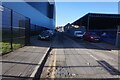
Glass House Row off Cleveland Street, Hull
https://www.geograph.org.uk/photo/6772396
Image: © Ian S
Taken: 26 Feb 2021
0.08 miles
10

Withernsea Street name plate, Stoneferry Road, Hull
https://www.geograph.org.uk/photo/6757774
Image: © Ian S
Taken: 17 Feb 2021
0.09 miles