
IMAGES TAKEN NEAR TO
Victoria Gardens, Victoria Avenue, HULL, HU5 3ED
Introduction
This page details the photographs taken nearby to Victoria Gardens, Victoria Avenue, HU5 3ED by members of the Geograph project.
The Geograph project started in 2005 with the aim of publishing, organising and preserving representative images for every square kilometre of Great Britain, Ireland and the Isle of Man.

There are currently over 7.5m images from over14,400 individuals and you can help contribute to the project by visiting https://www.geograph.org.uk
Image Map
Images are licensed for reuse under creativecommons.org/licenses/by-sa/2.0
Notes
- Clicking on the map will re-center to the selected point.
- The higher the marker number, the further away the image location is from the centre of the postcode.
Image Listing (123 Images Found)
Images are licensed for reuse under creativecommons.org/licenses/by-sa/2.0
Image
Details
Distance
2
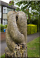
Tree sculpture, Hull
Carved tree stump at the end of Victoria Avenue. It one of many similar carved trees which decorate the verges of The Avenues area.
Image: © Paul Harrop
Taken: 25 May 2010
0.04 miles
3

Chanterlands Avenue, Kingston upon Hull
St Ninian's Presbyterian Church opened 1932, designed by J.F. Parkinson. Gothic features. The building was originally intended as the church hall, but has served as a place of worship to this day. In 1972 the Presbyterian Church of England and the Congregational Union in England & Wales came together to form the United Reformed Church. St Andrew’s Hall was added in 1984. http://stniniansandstandrews.urc.org.uk/?page_id=535
Image: © Bernard Sharp
Taken: 29 Mar 2014
0.05 miles
4
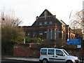
Church of St Ninian and St Andrew
A United Reformed church on Chanterlands Avenue, Hull.
Churches dedicated to this Scottish saint are rare in England.
Image: © Stephen Craven
Taken: 6 Jan 2011
0.05 miles


7

Railway bridge over Chanterlands Avenue, Hull
Image: © JThomas
Taken: 6 Apr 2010
0.06 miles

9

Chanterlands Avenue Railway Bridge
This bridge carries the loop line from the docks east of Hull, and whilst appearing to be in poor condition, is in regular use. The railway embankment acts as a wildlife corridor.
The dip under the bridge floods during periods of heavy rain.
This end of the avenue postdates the railways, being built in the early 1900s.
Image: © Peter Church
Taken: 16 Oct 2007
0.07 miles
10
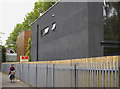
St Ninian's Walk, Hull
St Ninian's Walk is a footpath/snicket that runs between Chanterlands Avenue and Ella Street. The house on the right is one of several 'modernist' style architect-designed houses along the path.
Image: © Paul Harrop
Taken: 25 May 2010
0.07 miles