IMAGES TAKEN NEAR TO
Beech Tree Close, BEVERLEY, HU17 9UW
Introduction
This page details the photographs taken nearby to Beech Tree Close, HU17 9UW by members of the Geograph project.
The Geograph project started in 2005 with the aim of publishing, organising and preserving representative images for every square kilometre of Great Britain, Ireland and the Isle of Man.

There are currently over 7.5m images from over14,400 individuals and you can help contribute to the project by visiting https://www.geograph.org.uk
Image Map
Images are licensed for reuse under creativecommons.org/licenses/by-sa/2.0
Notes
- Clicking on the map will re-center to the selected point.
- The higher the marker number, the further away the image location is from the centre of the postcode.
Image Listing (48 Images Found)
Images are licensed for reuse under creativecommons.org/licenses/by-sa/2.0
Image
Details
Distance
3

Bushes between the recreation ground and railway line
Image: © N Chadwick
Taken: 31 Dec 2016
0.12 miles
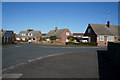
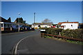
8
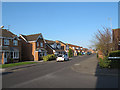
Nornabell Drive, Beverley
This housing estate was built c.2000.
Image: © Stephen Craven
Taken: 20 Apr 2013
0.15 miles
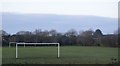
9
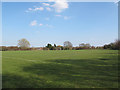
Football pitches off Thurlow Avenue
When the Molescroft estate was built, this section of land in the triangle of the former railway junction was left undeveloped. See also Image
Image: © Stephen Craven
Taken: 20 Apr 2013
0.16 miles