IMAGES TAKEN NEAR TO
Smithall Road, BEVERLEY, HU17 9GU
Introduction
This page details the photographs taken nearby to Smithall Road, HU17 9GU by members of the Geograph project.
The Geograph project started in 2005 with the aim of publishing, organising and preserving representative images for every square kilometre of Great Britain, Ireland and the Isle of Man.

There are currently over 7.5m images from over14,400 individuals and you can help contribute to the project by visiting https://www.geograph.org.uk
Image Map
Images are licensed for reuse under creativecommons.org/licenses/by-sa/2.0
Notes
- Clicking on the map will re-center to the selected point.
- The higher the marker number, the further away the image location is from the centre of the postcode.
Image Listing (28 Images Found)
Images are licensed for reuse under creativecommons.org/licenses/by-sa/2.0
Image
Details
Distance
1
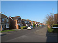
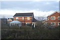
Nornabell Drive, Beverley
This housing estate was built c.2000.
Image: © Stephen Craven
Taken: 20 Apr 2013
0.04 miles
2

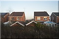
Grange Way
Looking east towards the railway bridge, at the junction of Lockwood Road with Grange Way, one sees this seemingly redundant access road.
Image: © Peter Church
Taken: 12 Mar 2009
0.05 miles
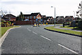
3
Northern Beverley housing estate
The housing visible here (on Nornabell Drive) is typical of the large numbers of homes built in the 1990s on land opened up by the Beverley north-eastern bypass.
Image: © Paul Harrop
Taken: 25 Nov 2007
0.06 miles
4
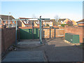
Sewage pumping station, Lockwood Road
I am guessing the function of this installation, from the vent pipe and the permanent hoist arrangement, which suggest a “wet well” type pumping station.
Image: © Stephen Craven
Taken: 20 Apr 2013
0.08 miles
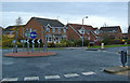
5
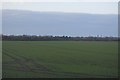
Hambling Drive - Nornabell Drive roundabout
Entering the north Beverley housing via Lockwood Road, estate from Grange Way one meets this roundabout.
Image: © Peter Church
Taken: 12 Mar 2009
0.08 miles
6
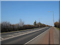
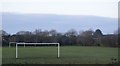
Grange Way, Beverley
This is the northern section of the town’s bypass, complete with segregated cycle lane. This view is eastwards, towards the railway bridge.
Image: © Stephen Craven
Taken: 20 Apr 2013
0.09 miles