IMAGES TAKEN NEAR TO
Thurstan Close, BEVERLEY, HU17 8LU
Introduction
This page details the photographs taken nearby to Thurstan Close, HU17 8LU by members of the Geograph project.
The Geograph project started in 2005 with the aim of publishing, organising and preserving representative images for every square kilometre of Great Britain, Ireland and the Isle of Man.

There are currently over 7.5m images from over14,400 individuals and you can help contribute to the project by visiting https://www.geograph.org.uk
Image Map
Images are licensed for reuse under creativecommons.org/licenses/by-sa/2.0
Notes
- Clicking on the map will re-center to the selected point.
- The higher the marker number, the further away the image location is from the centre of the postcode.
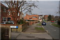
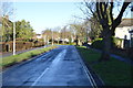
Image Listing (116 Images Found)
Images are licensed for reuse under creativecommons.org/licenses/by-sa/2.0
Image
Details
Distance
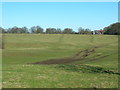
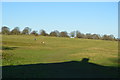
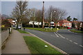
1
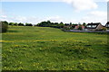
The edge of Beverley
The western side of Beverley is bounded by Westwood, common land where no further development can be contemplated.
Image: © Bill Boaden
Taken: 4 Jun 2012
0.02 miles
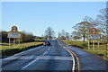

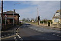
10
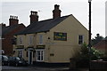
The Royal Oak on Cartwright Lane, Beverley
http://www.geograph.org.uk/photo/4392103 http://www.geograph.org.uk/photo/4392105
Image: © Ian S
Taken: 20 Mar 2015
0.06 miles