IMAGES TAKEN NEAR TO
Blanchard Avenue, BEVERLEY, HU17 0ZZ
Introduction
This page details the photographs taken nearby to Blanchard Avenue, HU17 0ZZ by members of the Geograph project.
The Geograph project started in 2005 with the aim of publishing, organising and preserving representative images for every square kilometre of Great Britain, Ireland and the Isle of Man.

There are currently over 7.5m images from over14,400 individuals and you can help contribute to the project by visiting https://www.geograph.org.uk
Image Map
Images are licensed for reuse under creativecommons.org/licenses/by-sa/2.0
Notes
- Clicking on the map will re-center to the selected point.
- The higher the marker number, the further away the image location is from the centre of the postcode.
Image Listing (54 Images Found)
Images are licensed for reuse under creativecommons.org/licenses/by-sa/2.0
Image
Details
Distance

4
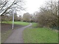
We have light
A lamp post on the path into Beverley.
Image: © Ian S
Taken: 26 Jul 2010
0.13 miles
5

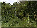
Willow Lane, Beverley
Seen from close to the route of the Beverley 20 recreational path, in the direction of Long Lane.
Image: © Paul Harrop
Taken: 8 Dec 2007
0.13 miles
6
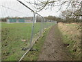
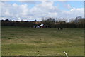
Beverley 20 between building site and drain
Another large housing estate brings Beverley's increasing size out to the southern bypass.
Image: © Martin Dawes
Taken: 19 Feb 2021
0.14 miles