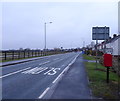
IMAGES TAKEN NEAR TO
Hull Road, BEVERLEY, HU17 0TR

Introduction

This page details the photographs taken nearby to Hull Road, HU17 0TR by members of the Geograph project.

The Geograph project started in 2005 with the aim of publishing, organising and preserving representative images for every square kilometre of Great Britain, Ireland and the Isle of Man.

There are currently over 7.5m images from over14,400 individuals and you can help contribute to the project by visiting https://www.geograph.org.uk

Image Map


Images are licensed for reuse under creativecommons.org/licenses/by-sa/2.0
Notes
  • Clicking on the map will re-center to the selected point.
  • The higher the marker number, the further away the image location is from the centre of the postcode.

Image Listing (51 Images Found)

Images are licensed for reuse under creativecommons.org/licenses/by-sa/2.0
  • ...
Image
Details
Distance
1
View from Long Lane towards Hull Road
The All74 through Dunswell and Woodmansey is an almost continuous ribbon of residential and commercial properties.
Image: © Jonathan Thacker Taken: 29 Jan 2016
0.03 miles
2
Houses on Hull Road, Woodmansey
Image: © JThomas Taken: 21 Dec 2019
0.03 miles
3
Old Milestone
Old milestone on the A1174 near to Woodmansey, East Riding of Yorkshire. For overall view see http://www.geograph.org.uk/photo/4102063
Image: © Keith Evans Taken: 26 Jul 2014
0.03 miles
4
Old Milestone, on the A1174, 150m S of Woodmansey Church
Located on the East side of road, by low garden wall in front of white bungalow by LP58. Stone post (plate lost), Mounting Block - 3 step design, 19th century. Alternative views see http://www.geograph.org.uk/photo/4102063 & http://www.geograph.org.uk/photo/4102056 Milestone Society National ID: YE_HLBV06
Image: © John Harland Taken: 1 Jan 2006
0.04 miles
5
Old milestone
This eroded sandstone milestone probably has three steps with the lower one under soil level. It is on the A1174 just south of Woodmansey church and by lamppost 58. The tombstone shape of the missing plate which was inset into the stone and fixed by one large peg at the top can be seen. It is on the east side of the road.
Image: © Chris Minto Taken: 10 Apr 2022
0.04 miles
6
Hull Road (A1174), Woodmansey
Showing position of Postbox No. HU17 247. See Image] for postbox.
Image: © JThomas Taken: 21 Dec 2019
0.04 miles
7
Hull Road (A1174)
Heading north west towards Beverley.
Image: © JThomas Taken: 14 Feb 2015
0.05 miles
8
Close up, Elizabeth II postbox on Hull Road, Woodmansey
Postbox No. HU17 247. See Image] for wider view.
Image: © JThomas Taken: 21 Dec 2019
0.05 miles
9
Elizabeth II postbox on Hull Road, Woodmansey
Postbox No. HU17 247. See Image] for close up. See Image], Image] and Image] for context.
Image: © JThomas Taken: 21 Dec 2019
0.05 miles
10
Cycle path beside Hull Road (A1174)
Heading north west.
Image: © JThomas Taken: 14 Feb 2015
0.05 miles
  • ...