IMAGES TAKEN NEAR TO
River View, BEVERLEY, HU17 0SL
Introduction
This page details the photographs taken nearby to River View, HU17 0SL by members of the Geograph project.
The Geograph project started in 2005 with the aim of publishing, organising and preserving representative images for every square kilometre of Great Britain, Ireland and the Isle of Man.

There are currently over 7.5m images from over14,400 individuals and you can help contribute to the project by visiting https://www.geograph.org.uk
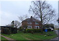
Image Map
Images are licensed for reuse under creativecommons.org/licenses/by-sa/2.0
Notes
- Clicking on the map will re-center to the selected point.
- The higher the marker number, the further away the image location is from the centre of the postcode.
Image Listing (49 Images Found)
Images are licensed for reuse under creativecommons.org/licenses/by-sa/2.0
Image
Details
Distance
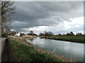
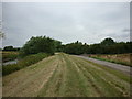
2
A walk along the River Hull #29
Looking back on the way I've just walked. It is a public right of way and nobody can stop you.
Image: © Ian S
Taken: 6 Aug 2010
0.02 miles
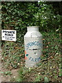
3

A walk along the River Hull #30
Weel Road with Carr Lane on the right.
Image: © Ian S
Taken: 6 Aug 2010
0.02 miles
4
Weel from south-west side of River Hull
Image: © Chris Morgan
Taken: 28 Apr 2015
0.03 miles
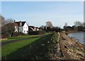
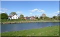
5

River Hull at Weel
Some of the houses in this hamlet are visible on the left, on the north side of this meandering stretch of the river Hull east of Beverley.
Image: © Paul Harrop
Taken: 11 Jan 2022
0.04 miles
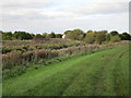
6
A walk along the River Hull #28
The outskirts of Weel.
Image: © Ian S
Taken: 6 Aug 2010
0.04 miles