
IMAGES TAKEN NEAR TO
Springfield Avenue, BROUGH, HU15 1BX
Introduction
This page details the photographs taken nearby to Springfield Avenue, HU15 1BX by members of the Geograph project.
The Geograph project started in 2005 with the aim of publishing, organising and preserving representative images for every square kilometre of Great Britain, Ireland and the Isle of Man.

There are currently over 7.5m images from over14,400 individuals and you can help contribute to the project by visiting https://www.geograph.org.uk
Image Map
Images are licensed for reuse under creativecommons.org/licenses/by-sa/2.0
Notes
- Clicking on the map will re-center to the selected point.
- The higher the marker number, the further away the image location is from the centre of the postcode.
Image Listing (28 Images Found)
Images are licensed for reuse under creativecommons.org/licenses/by-sa/2.0
Image
Details
Distance
1
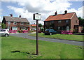
Springfield Avenue, Brough
The East Riding of Yorkshire Council's sign reads NO HARD BALL GAMES. One can only assume it's OK to play easy ball games. Anyone for a game of cricket?
Image: © Paul Glazzard
Taken: 13 Jul 2008
0.07 miles
3
The road to Brough
Taken on the Hull to Brough road at MR: SE94592689 looking westwards.
Image: © Andy Beecroft
Taken: 1 Mar 2006
0.17 miles
5
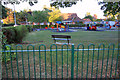
Playground and Village Hall, Brough
The village hall hosts the Petuaria Players, Petuaria being the Roman name for Brough, which is situated on the north bank of the Humber, en route from Lincoln to York.
Image: © Peter Church
Taken: 25 Jun 2009
0.18 miles
6
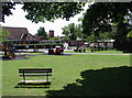
Elloughton Road Playground
Playground on the east side of Elloughton Road, Brough, outside Elloughton cum Brough Village Hall and close to Brough County Primary School.
Image: © Paul Glazzard
Taken: 13 Jul 2008
0.19 miles
9
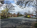
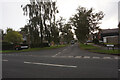
Welton Road, Brough
Photo taken from a position close to The Red Hawk public house.
Image: © David Wright
Taken: 5 Apr 2008
0.20 miles
10
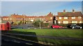
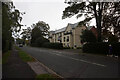
Houses, Brough
Seen from a bus on Welton Road. Separated from it by grass is Humber Crescent; on the left, Thorpe Road leads to The Oval.
Image: © Derek Harper
Taken: 5 Jan 2014
0.20 miles