
IMAGES TAKEN NEAR TO
Albion Street, HULL, HU1 3TH
Introduction
This page details the photographs taken nearby to Albion Street, HU1 3TH by members of the Geograph project.
The Geograph project started in 2005 with the aim of publishing, organising and preserving representative images for every square kilometre of Great Britain, Ireland and the Isle of Man.

There are currently over 7.5m images from over14,400 individuals and you can help contribute to the project by visiting https://www.geograph.org.uk
Image Map
Images are licensed for reuse under creativecommons.org/licenses/by-sa/2.0
Notes
- Clicking on the map will re-center to the selected point.
- The higher the marker number, the further away the image location is from the centre of the postcode.
Image Listing (2806 Images Found)
Images are licensed for reuse under creativecommons.org/licenses/by-sa/2.0
Image
Details
Distance
1

Albion Street scaffolding, Hull
The eastern end of the row of Grade II listed, late 18th century three-storey houses (seen unclad in Image) would appear to be currently undergoing renovation, with the frontages almost completely obscured by scaffolding.
Image: © Paul Harrop
Taken: 30 Apr 2024
0.00 miles
2

House on Baker Street, Hull
This part of Baker Street contains a number of properties that appear to have originally served as stables or coach houses.
Image: © David Wright
Taken: 12 Apr 2008
0.01 miles
3

Union Street, Hull
It is thought that this stable block and cart sheds on Union Street (now the offices of a firm of architects) were probably ancillary buildings to the home of Richard Baker, a tobacco merchant who was involved in the development of this area in the late 18th century.
Image: © Paul Glazzard
Taken: 12 Aug 2006
0.01 miles
4

Rear Elevation of 17-30 Albion Street, Hull
This photo was taken from Baker Street and shows the rear elevation of 17-30 Albion Street Image Obviously some care was taken to give the back of these buildings an attractive appearance. The red brick building in the left foreground is modern infill.
Image: © David Wright
Taken: 3 Dec 2007
0.01 miles
5

19-30 Albion Street, Hull
A good run of Georgian houses, built 1794-96. They are of three storeys plus basement, with Doric porches and keystones above the windows. Some are two bays, others three, a reflection of the fact they were in fact built by different developers. Grade II listed.
Image: © Stephen Richards
Taken: 16 Jun 2011
0.01 miles
6

Albion Street, Kingston upon Hull
The construction of houses, 1795-97, at Nos.17-30 Albion Street, north side, between Percy Street and Union Street, was part of the development of the Estate of Richard Baker on the southern close of Charterhouse Ings Magna. All the properties are Grade II Listed Buildings.
Image: © Bernard Sharp
Taken: 17 Feb 2018
0.01 miles


9

Albion Street, Kingston upon Hull
The construction of houses, 1795-97, at Nos.17-30 Albion Street, north side, between Percy Street and Union Street, was part of the development of the Estate of Richard Baker on the southern close of Charterhouse Ings Magna.
Depicted are Nos.24 to 26, all of which are Grade II Listed Buildings: No.24: http://www.britishlistedbuildings.co.uk/en-387413-number-24-and-attached-railings- No.25: http://www.britishlistedbuildings.co.uk/en-387414-25-and-attached-railings- No.26: http://www.britishlistedbuildings.co.uk/en-387415-number-26-and-attached-railings-
The basement of No.24 is occupied by The Hop & Vine, the city's smallest public house: http://www.hopandvinehull.co.uk/Home/Home.aspx
Image: © Bernard Sharp
Taken: 29 May 2014
0.01 miles
10
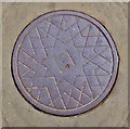
Albion Street, Kingston upon Hull
In the 19th century many buildings in larger towns had a coal hole in the pavement to allow the coal merchant to empty his sacks into the coal bunker, which was often in the cellar at the front of the house, without the need to enter the house. The hole was normally between 30 and 60 cm in diameter and was lined by a cast-iron ring and covered by a cast-iron plate. This often advertised the name of the maker. They were normally given a raised pattern to prevent slipping and some include glass or concrete panels. Covers are more common from the 1860s onwards but became redundant after the implementation of the Clean Air Acts.
This star design is the only one of its type of the three surviving covers in the pavement serving the former houses at Nos.17 to 30 Albion Street, built 1795-97.
Image: © Bernard Sharp
Taken: 5 Mar 2014
0.01 miles