
IMAGES TAKEN NEAR TO
Station Road, HESSLE, HU13 0BB
Introduction
This page details the photographs taken nearby to Station Road, HU13 0BB by members of the Geograph project.
The Geograph project started in 2005 with the aim of publishing, organising and preserving representative images for every square kilometre of Great Britain, Ireland and the Isle of Man.

There are currently over 7.5m images from over14,400 individuals and you can help contribute to the project by visiting https://www.geograph.org.uk
Image Map
Images are licensed for reuse under creativecommons.org/licenses/by-sa/2.0
Notes
- Clicking on the map will re-center to the selected point.
- The higher the marker number, the further away the image location is from the centre of the postcode.
Image Listing (353 Images Found)
Images are licensed for reuse under creativecommons.org/licenses/by-sa/2.0
Image
Details
Distance
1
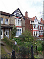
"Chiverton", Station Road, Hessle
Hessle has a large number of Victorian and Edwardian houses.
Image: © David Wright
Taken: 10 Mar 2007
0.02 miles
3

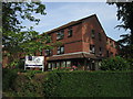
South Lane, Hessle, Yorkshire
At the junction with Station Road, apartments at Nos.1 to 32 Laburnum Court, South Lane, constructed on the site of the Trinity Congregational Church.
Image: © Bernard Sharp
Taken: 15 Dec 2016
0.02 miles
4

Town Hall, South Lane, Hessle
Many people refer to Hessle as "the village" but it has a town hall.
Image: © Charles Rispin
Taken: 14 Oct 2006
0.02 miles
5

Hessle Nursing Home
Once Hessle Nursing Home, later a gas show room, now Premier office. On South Lane, Hessle.
Image: © Charles Rispin
Taken: 14 Oct 2006
0.02 miles
6

Trinity United Reformed Church, South Lane, Hessle
A rather undistinguished building not rating a listing in Pevsner.
Image: © David Wright
Taken: 10 Mar 2007
0.02 miles
7

South Lane, Hessle, Yorkshire
Apartments at Nos.1 to 9 Trinity Court, South Lane, built circa 2008 on the site of the Sunday Schoolroom and Hall of the former Trinity Congregational Church. In the perimeter wall are embedded three foundation stones, believed to originate from the said schoolroom; for detail, see: Image
Image: © Bernard Sharp
Taken: 15 Dec 2016
0.03 miles
8

South Lane, Hessle, Yorkshire
The Sunday Schoolroom attached to the former Trinity Congregational Chapel may be no longer extant, but a reminder continues in the form of three foundation stones, each dated 16 October 1924, embedded in the southern boundary wall of the adjacent dwellings at Trinity Court, South Lane. The stones were laid by Mrs. Somervell (illustrated), Geo. E. Westerdale and Mrs. J.? E. Whitehead.
The assistance given by Michael Free and Pat Howlett, archivist, Hessle Local History Society https://www.sites.google.com/site/hesslelocalhistorysociety/home , in identifying these foundation stones is much appreciated.
Image: © Bernard Sharp
Taken: 1 Dec 2016
0.03 miles
9

"Norwood", Chestnut Avenue, Hessle
Chestnut Avenue is part of the Davenport Estate which was laid out in 1895 and largely complete by 1905. To quote Pevsner "It is a period piece, an enclave of middle-class villas and semi-detached houses exhibiting all the hallmarks of minor late Victorian and Edwardian suburban architecture.".
Image: © David Wright
Taken: 10 Mar 2007
0.03 miles
