
IMAGES TAKEN NEAR TO
Knockaird, ISLE OF LEWIS, HS2 0XF
Introduction
This page details the photographs taken nearby to HS2 0XF by members of the Geograph project.
The Geograph project started in 2005 with the aim of publishing, organising and preserving representative images for every square kilometre of Great Britain, Ireland and the Isle of Man.

There are currently over 7.5m images from over14,400 individuals and you can help contribute to the project by visiting https://www.geograph.org.uk
Image Map
Images are licensed for reuse under creativecommons.org/licenses/by-sa/2.0
Notes
- Clicking on the map will re-center to the selected point.
- The higher the marker number, the further away the image location is from the centre of the postcode.
Image Listing (11 Images Found)
Images are licensed for reuse under creativecommons.org/licenses/by-sa/2.0
Image
Details
Distance
1
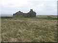
Roofless house at Coig Peighinnean
Also known as Five Penny Ness, part of the crofting community at the north end of Lewis.
Image: © M J Richardson
Taken: 13 May 2013
0.07 miles
2
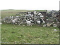
Lambs seeking shelter
Cowering from wind and rain, sheltered by the remains of old stone houses.
Image: © M J Richardson
Taken: 13 May 2013
0.10 miles
3
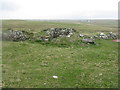
Blackhouse remains at Coig Peighinnean
The thick-walled bases of ancient stone croft houses.
Image: © M J Richardson
Taken: 13 May 2013
0.11 miles
4
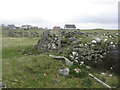
Old houses at Coig Peighinnean
Remains of blackhouses or similar in a crofting community
Image: © M J Richardson
Taken: 13 May 2013
0.11 miles
5
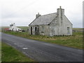
Houses at Coig Peighinnean
One in use, the other in need of attention.
Image: © M J Richardson
Taken: 13 May 2013
0.12 miles
6
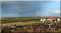
An Cnoc Ard View
Looking towards Loch Stiapabhat on a blustery autumn day.
Image: © Mary and Angus Hogg
Taken: 4 Oct 2017
0.12 miles
7
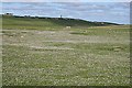
Loch Stiapabhat
A signpost indicates a path to a nature reserve at Loch Stiapabhat, which is flanked by some marshy ground to the west. Above the loch, on the hill, is the water tower in An Cnoc Ard.
Image: © Anne Burgess
Taken: 2 Jun 2009
0.19 miles
8
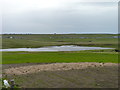
Loch Stiapabhat
A small nature reserve for wildfowl.
Image: © James Allan
Taken: 25 May 2013
0.19 miles
9
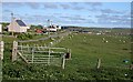
An Cnoc Ard
This name means something like 'the high lump', and it is the highest part of the Nis district.
Image: © Anne Burgess
Taken: 2 Jun 2009
0.22 miles
10
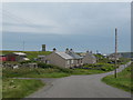
An Cnoc Ard
The township of An Cnoc Ard with the concrete water tower on a small hill.
Image: © Gordon Hatton
Taken: 16 Jul 2007
0.23 miles