IMAGES TAKEN NEAR TO
Pomona Grove, ROSS-ON-WYE, HR9 7WB
Introduction
This page details the photographs taken nearby to Pomona Grove, HR9 7WB by members of the Geograph project.
The Geograph project started in 2005 with the aim of publishing, organising and preserving representative images for every square kilometre of Great Britain, Ireland and the Isle of Man.

There are currently over 7.5m images from over14,400 individuals and you can help contribute to the project by visiting https://www.geograph.org.uk
Image Map
Images are licensed for reuse under creativecommons.org/licenses/by-sa/2.0
Notes
- Clicking on the map will re-center to the selected point.
- The higher the marker number, the further away the image location is from the centre of the postcode.
Image Listing (26 Images Found)
Images are licensed for reuse under creativecommons.org/licenses/by-sa/2.0
Image
Details
Distance
2
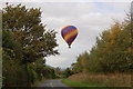
Powell's Croft, Upton Bishop
The top of May Hill can be seen between the two houses at the end.
Image: © Jonathan Billinger
Taken: 24 Mar 2009
0.11 miles
3
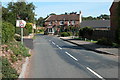
'The Moody Cow', Crow Hill
The Moody Cow stands on a cross roads in the middle of the village.
Image: © Philip Halling
Taken: 24 Sep 2005
0.14 miles
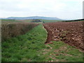
5
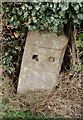
Old Milestone by the B4224, south of Crow Hill
Stone post (plate lost) by the B4224, in parish of UPTON BISHOP (District), South of Crow Hill, just South of field entrance and village sign, on West side of road. Erected by the Hereford turnpike trust in the 19th century.
Inscription once read:-
(TO)
(HEREFORD)
(13)
(MILES)
Carved benchmark front middle bottom.
Herefordshire SMR listed. SMR Number: 56478
https://www.heritagegateway.org.uk/Gateway/Results_Single.aspx?uid=MHE28335&resourceID=101
Milestone Society National ID: HF_HFGL13.
Image: © M Faherty
Taken: 12 Apr 2010
0.16 miles
6
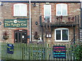
The Moody Cow
A pub/restaurant at Crow Hill, Upton Bishop.
Image: © Jonathan Billinger
Taken: 1 Dec 2008
0.17 miles
7
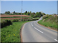
Approaching Crow Hill from the south
The B4224 runs from Mitcheldean to Hereford.
Image: © Pauline E
Taken: 20 Apr 2009
0.18 miles
8
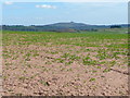
Arable land near Upton Bishop
The crop is rape, and the familiar dome of May Hill is in the blue distance.
Image: © Jonathan Billinger
Taken: 24 Mar 2009
0.18 miles
9
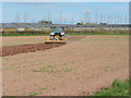
Harrowing down the land
The mild, dry conditions have helped the farmers get the work done so far this spring of 2009.
Image: © Jonathan Billinger
Taken: 24 Mar 2009
0.18 miles