1
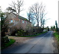
Silver Birches, Archenfield
Modern dormitory housing on the edge of Ross on Wye. About fifty yards off camera to the left, the character of the area changes completely, from suburbia to an idyllic leafy country lane which you can imagine the Famous Five riding their bicycles along. Except Timmy, who was a dog and couldn't ride a bicycle; he'd have been running alongside.
Image: © John Winder
Taken: 27 Jul 2014
0.03 miles
2
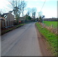
Hom Green Road
At the point of derestriction to the west of Ross-on-Wye.
Image: © Jonathan Billinger
Taken: 18 Sep 2008
0.05 miles
3
Northern end of Roman Way, Ross-on-Wye
Viewed from Archenfield Road. Roman Way is the main road through an area of modern houses where some of the street names have Latin or Ancient Roman themes, such as Corinium Road, Watling Street, Isca Close.
Image: © Jaggery
Taken: 24 Feb 2012
0.05 miles
4
Archenfield, Ross on Wye - Gatehouse
Lovely hexagonal gatehouse at the entrance to "the White House". Still occupied.
Image: © Tony Bailey
Taken: 24 Apr 2006
0.05 miles
5
Archenfield Road heads out of Ross-on-Wye
The road heads past the Coach House, towards Walford via Hom Green.
A hexagonal lodge http://www.geograph.org.uk/photo/158223 is in the middle background.
Image: © Jaggery
Taken: 24 Feb 2012
0.05 miles
6
Pink house at Archenfield
On Lincoln Hill. The road appears very rural here, but about fifty yards behind me the character of the area changes completely and takes on the appearance of a suburban dormitory town as might be found on the edge of a large city.
Image: © John Winder
Taken: 27 Jul 2014
0.06 miles
7
End of the 30mph speed limit at the SW edge of Ross-on-Wye
A few metres west of Roman Way http://www.geograph.org.uk/photo/2823566 the 30mph speed limit
in Ross-on-Wye increases to the National Speed Limit.
Image: © Jaggery
Taken: 24 Feb 2012
0.08 miles
8
Gated track to Lower Cleeve Farm
No allowance or signage for the footpath indicated on mapping.
Image: © Jonathan Billinger
Taken: 5 Jan 2021
0.10 miles
9
Edge of housing, Ross-on-Wye
By Roman Way, with Chase Hill in the distance.
Image: © Jonathan Billinger
Taken: 18 Sep 2008
0.12 miles
10
Roman Way houses, Archenfield, Ross-on-Wye
Looking towards the left turn into Beech Close, behind the car.
Image: © Jaggery
Taken: 24 Feb 2012
0.13 miles


