IMAGES TAKEN NEAR TO
Phocle Green, ROSS-ON-WYE, HR9 7TN
Introduction
This page details the photographs taken nearby to HR9 7TN by members of the Geograph project.
The Geograph project started in 2005 with the aim of publishing, organising and preserving representative images for every square kilometre of Great Britain, Ireland and the Isle of Man.

There are currently over 7.5m images from over14,400 individuals and you can help contribute to the project by visiting https://www.geograph.org.uk
Image Map
Images are licensed for reuse under creativecommons.org/licenses/by-sa/2.0
Notes
- Clicking on the map will re-center to the selected point.
- The higher the marker number, the further away the image location is from the centre of the postcode.
Image Listing (7 Images Found)
Images are licensed for reuse under creativecommons.org/licenses/by-sa/2.0
Image
Details
Distance
1
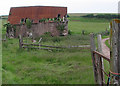
Derelict barn at Upper Foxhall
There are other dwellings in the area and it must have been a fantastic hideaway before the M50 was opened. I love the colour of the rusty corrugated roof - looks great with the red sandstone - although I'm sure the farmer who built it was more interested in its functionality.
Image: © Pauline E
Taken: 7 Jun 2007
0.07 miles
2
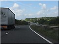
M50 Motorway sweeps through Gloucestershire
A fine vista from the crest near Upper Foxhall. In the far distance is the attractive arched bridge near Rudhall House. Not much motorway left now.
Image: © J Whatley
Taken: 31 Aug 2010
0.09 miles
3
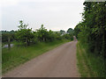
M50 and country lane run parallel at Upper Foxhall
They couldn't get much closer.
Image: © Pauline E
Taken: 7 Jun 2007
0.10 miles