IMAGES TAKEN NEAR TO
Phocle Green, ROSS-ON-WYE, HR9 7TL
Introduction
This page details the photographs taken nearby to HR9 7TL by members of the Geograph project.
The Geograph project started in 2005 with the aim of publishing, organising and preserving representative images for every square kilometre of Great Britain, Ireland and the Isle of Man.

There are currently over 7.5m images from over14,400 individuals and you can help contribute to the project by visiting https://www.geograph.org.uk
Image Map (Loading...)


Getting Data...Please wait
Leaflet Map data © OpenStreetMap
Images are licensed for reuse under creativecommons.org/licenses/by-sa/2.0
Notes
- Clicking on the map will re-center to the selected point.
- The higher the marker number, the further away the image location is from the centre of the postcode.
Image Listing (23 Images Found)
Images are licensed for reuse under creativecommons.org/licenses/by-sa/2.0
Image
Details
Distance
2
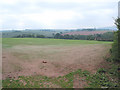
Turf-growing land
Picture, taken almost one year after Image, shows how well the grass sward has developed - it has just been mowed.
There is great demand for turf in May after the Football season has finished.
The buildings to the right are Rudhall Cottages.
Image: © Jonathan Billinger
Taken: 19 May 2008
0.03 miles
3
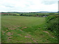
Herefordshire in autumn 1
Typical patchwork landscape over the Rudhall valley towards May Hill.
Image: © Jonathan Billinger
Taken: 6 Oct 2011
0.10 miles
4
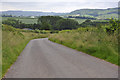
The lane to Rudhall
Herefordshire country lane looking in the direction of Rudhall.
Image: © Stuart Wilding
Taken: 15 Jun 2014
0.10 miles
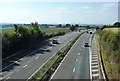
5
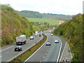
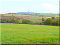
Herefordshire's motorway
A view east along the M50 on an autumn afternoon.
Herefordshire has only a few miles of motorway, but more than Dorset, Cornwall and Norfolk put together.
Image: © Jonathan Billinger
Taken: 6 Oct 2011
0.12 miles
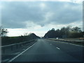
7
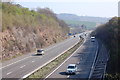
M50 Motorway near Rudhall
As usual on the M50, curtailment of the emergency lane gives away the presence of a bridge.
Image: © J Whatley
Taken: 31 Aug 2010
0.13 miles
8
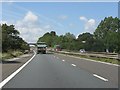
Western end of the M50
View of the 21 mile long M50 which passes through Gloucestershire, Worcestershire and Herefordshire.
Image: © Stuart Wilding
Taken: 15 Jun 2014
0.14 miles
10
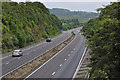
M50 near Rudhall
Looking eastwards along the M50 where minor road crosses near Rudhall. The Malvern Hills are visible in the distance
Image: © Clint Mann
Taken: 7 Sep 2014
0.14 miles