
IMAGES TAKEN NEAR TO
Homs Road, ROSS-ON-WYE, HR9 7DG
Introduction
This page details the photographs taken nearby to Homs Road, HR9 7DG by members of the Geograph project.
The Geograph project started in 2005 with the aim of publishing, organising and preserving representative images for every square kilometre of Great Britain, Ireland and the Isle of Man.

There are currently over 7.5m images from over14,400 individuals and you can help contribute to the project by visiting https://www.geograph.org.uk
Image Map
Images are licensed for reuse under creativecommons.org/licenses/by-sa/2.0
Notes
- Clicking on the map will re-center to the selected point.
- The higher the marker number, the further away the image location is from the centre of the postcode.
Image Listing (149 Images Found)
Images are licensed for reuse under creativecommons.org/licenses/by-sa/2.0
Image
Details
Distance
1
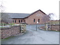
Kingdom Hall, Ross-on-Wye
The church of the Jehovah's Witnesses on Hom Road.
Image: © Jonathan Billinger
Taken: 18 Jan 2007
0.05 miles
2
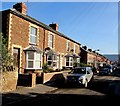
Homs Road houses, Ross-on-Wye
Located 300 metres east of the River Wye, at the edge of a flood plain.
Image: © Jaggery
Taken: 8 Feb 2015
0.08 miles
3
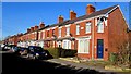
Prospect Terrace, Ross-on-Wye
Viewed across Homs Road.
Image: © Jaggery
Taken: 8 Feb 2015
0.10 miles
4

Course of old railway near Ross on Wye
This shot shows the bridge which was constructed over the doomed railway line from Gloucester to Hereford. The underside of this bridge is still painted black along the line of the old railway, presumably to disguise the smoke staining from the steam engines. The line was not in use for long after the bridge was built, this section closing to all traffic in late 1964. Taken looking towards Gloucester.
Image: © John Winder
Taken: 19 Apr 2014
0.10 miles
5
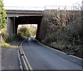
Bridge over Homs Road, Ross-on-Wye
The A40 passes over Homs Road.
Image: © Jaggery
Taken: 8 Feb 2015
0.11 miles
6
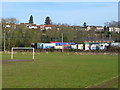
Wye floodplain 2
The view over a football pitch towards the Verschoyle Gardens suburb of Ross-on-Wye (on the hill) with a fairground storage area in between.
Image: © Jonathan Billinger
Taken: 24 Jan 2009
0.11 miles
7

Fairground equipment storage area, Ross-on-Wye
Set back from the west side of Homs Road.
Image: © Jaggery
Taken: 8 Feb 2015
0.11 miles
8
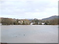
Ross-under-Wye II
The latest floods by the river in a view eastwards from the bypass, with the dome of May Hill looming in the distance.
Image: © Jonathan Billinger
Taken: 11 Jan 2007
0.12 miles
9
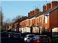
Terraced housing, Homs Road
Glinting in low December afternoon sunshine.
Image: © Jonathan Billinger
Taken: 27 Dec 2017
0.13 miles
10
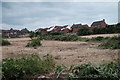
Former allotments
Planning permission for the development of a housing estate on this field has been in place for a few years now, and the site has recently been cleared. When I moved to Ross 11 years ago, this was all allotments: "I remember when this didn't used to be all fields", you might say. In the background are houses on River View.
Image: © John Winder
Taken: 9 Jun 2020
0.14 miles