IMAGES TAKEN NEAR TO
Llangarron, ROSS-ON-WYE, HR9 6NG
Introduction
This page details the photographs taken nearby to HR9 6NG by members of the Geograph project.
The Geograph project started in 2005 with the aim of publishing, organising and preserving representative images for every square kilometre of Great Britain, Ireland and the Isle of Man.

There are currently over 7.5m images from over14,400 individuals and you can help contribute to the project by visiting https://www.geograph.org.uk
Image Map
Images are licensed for reuse under creativecommons.org/licenses/by-sa/2.0
Notes
- Clicking on the map will re-center to the selected point.
- The higher the marker number, the further away the image location is from the centre of the postcode.
Image Listing (9 Images Found)
Images are licensed for reuse under creativecommons.org/licenses/by-sa/2.0
Image
Details
Distance
1
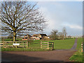
Bernithan Court Farm
Overlooking the village of Llangarron.
Image: © Pauline E
Taken: 4 Feb 2008
0.09 miles
2
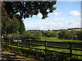
Bernithan Court
Beautifully situated NE of Llangarron.
Image: © Pauline E
Taken: 8 Oct 2008
0.09 miles
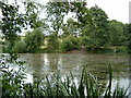
4
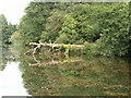
Redmire Pool 2012 fallen Oak
Once famous Carp Fishery with fallen Oak and very heavy weed
Image: © Chris Wynne
Taken: 25 Aug 2012
0.16 miles
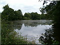
5
Redmire Pool 2012 choked with weed again
Redmire Pool near Llangarron choked with weed again
Image: © Chris Wynne
Taken: 26 Aug 2012
0.17 miles
6
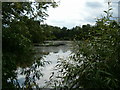
Redmire Pool overgrown 2012
Redmire Pool overgrown and weeded 2012
Image: © Chris Wynne
Taken: 26 Aug 2012
0.19 miles
7
Redmire Pool 2012
Redmire Pool 2012 overgrown and choked with weed
Image: © Chris Wynne
Taken: 26 Aug 2012
0.20 miles
8
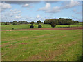
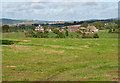
Bernithan Wood
NE of Bernithan Court Farm. The road from Llangarron to Glewstone cuts through the picture.
Image: © Pauline E
Taken: 8 Oct 2008
0.24 miles
9
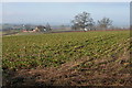
View across the Garren Brook
From the minor road to Langstone Court.
Image: © Pauline E
Taken: 3 Oct 2008
0.24 miles