
IMAGES TAKEN NEAR TO
Roman Way, ROSS-ON-WYE, HR9 5UY
Introduction
This page details the photographs taken nearby to Roman Way, HR9 5UY by members of the Geograph project.
The Geograph project started in 2005 with the aim of publishing, organising and preserving representative images for every square kilometre of Great Britain, Ireland and the Isle of Man.

There are currently over 7.5m images from over14,400 individuals and you can help contribute to the project by visiting https://www.geograph.org.uk
Image Map
Images are licensed for reuse under creativecommons.org/licenses/by-sa/2.0
Notes
- Clicking on the map will re-center to the selected point.
- The higher the marker number, the further away the image location is from the centre of the postcode.
Image Listing (95 Images Found)
Images are licensed for reuse under creativecommons.org/licenses/by-sa/2.0
Image
Details
Distance
1
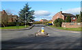
Eastern end of Roman Way, Ross-on-Wye
Viewed across Walford Road. Roman Way is the main road through an area of modern houses where some of the street names have Latin or Ancient Roman themes, such as Corinium Road, Watling Street, Isca Close.
Image: © Jaggery
Taken: 24 Feb 2012
0.05 miles
2

Snowdrops and windfall apples
The mild winter has meant that the local wild birds have been kept busy out in the fields, not in suburban gardens so the apples are still around at the end of January.
Image: © Jonathan Billinger
Taken: 29 Jan 2016
0.05 miles
3
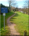
Betzdorf Walk, Ross-on-Wye
The track heads SW away from Walford Road. A 1940s map shows that this was
the route of a railway line, now part of the Town and Country Trail.
Betzdorf in Germany is one of Ross-on-Wye's twin towns.
Image: © Jaggery
Taken: 24 Feb 2012
0.06 miles
4
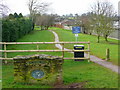
Betzdorf Walk 1
What used to be the Ross-on-Wye to Monmouth line.
It forms the extension to the Town and Country path and is surrounded by housing estates.
Image: © Jonathan Billinger
Taken: 24 Jan 2009
0.06 miles
5
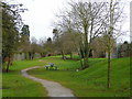
Betzdorf Walk 2
What used to be the Ross-on-Wye to Monmouth line.
It forms the extension to the Town and Country path and is surrounded by housing estates.
Image: © Jonathan Billinger
Taken: 24 Jan 2009
0.07 miles
6
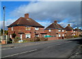
Walford Road houses, Ross-on-Wye
Viewed from the corner of Chapel Road.
Image: © Jaggery
Taken: 24 Feb 2012
0.08 miles
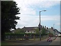
8
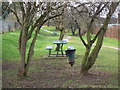
Picnic area on Betzdorf Walk Ross-on-Wye
Picnic table on the Town and Country trail around Ross-on-Wye.
Image: © Linda Billinger
Taken: 24 Jan 2009
0.09 miles
9
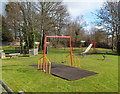
Childs Garden play area, Ross-on-Wye
Located on the east side of the B4234 Walford Road. A nearby plaque shows that Childs Garden is dedicated to the memory of Ron and Joyce Childs, mayor and mayoress of Ross 1979-1980.
Image: © Jaggery
Taken: 24 Feb 2012
0.09 miles
10
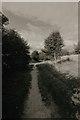
The Betzdorf Walk, Tudorville
On the edge of Ross on Wye. This is actually the trackbed of the old Ross - Monmouth railway, closed as a through route before Dr Beeching could get his hands on it (which he undoubtedly would have done!) in January 1959. This section remained open as far as Lydbrook for freight traffic, effectively being operated as a long siding from Ross for the Lydbrook cable factory, until 1964. Nowadays, it's known as The Betzdorf Walk after one of Ross's twin towns, and is part of the buggy route which is accessible to wheelchairs and pushchairs.
Image: © John Winder
Taken: Unknown
0.09 miles