
IMAGES TAKEN NEAR TO
Leys Hill, Walford, ROSS-ON-WYE, HR9 5QU
Introduction
This page details the photographs taken nearby to HR9 5QU by members of the Geograph project.
The Geograph project started in 2005 with the aim of publishing, organising and preserving representative images for every square kilometre of Great Britain, Ireland and the Isle of Man.

There are currently over 7.5m images from over14,400 individuals and you can help contribute to the project by visiting https://www.geograph.org.uk
Image Map
Images are licensed for reuse under creativecommons.org/licenses/by-sa/2.0
Notes
- Clicking on the map will re-center to the selected point.
- The higher the marker number, the further away the image location is from the centre of the postcode.
Image Listing (14 Images Found)
Images are licensed for reuse under creativecommons.org/licenses/by-sa/2.0
Image
Details
Distance
1
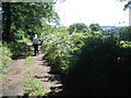
Lane near Warren Farm
Looking southwards, with the hills of Ruardean in the distance. Despite being on the hillside, this lane was still showing signs of the great rains of July 2007 and in places was totally under water.
Image: © Trevor Rickard
Taken: 31 Jul 2007
0.01 miles
2
![A walk from Kerne Bridge to Ross-on-Wye [12]](https://s3.geograph.org.uk/geophotos/07/35/08/7350815_41c4d802_120x120.jpg)
A walk from Kerne Bridge to Ross-on-Wye [12]
The broad track, a public bridleway, runs through woodland.
The walk leaves Kerne Bridge, ascends Ley Hill then takes a bridleway through Warren Wood to Forest Green. A minor road is then followed to Bull’s Hill where the long distance Wye Valley Walk is joined. Bridleways and footpaths are then taken to Coughton and the start of the steep ascent through Chase Wood to the hillfort on top of the plateau. A descent through Merrivale Wood takes the route to its destination in Ross-on-Wye. About 4½ miles.
Image: © Michael Dibb
Taken: 1 Sep 2022
0.13 miles
3
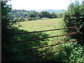
Meadow above Kerne Bridge
Looking westwards with Leys Hill Farm just below the other side of the field.
Image: © Trevor Rickard
Taken: 31 Jul 2007
0.14 miles
4
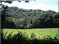
Meadow above Kerne Bridge
Looking south-west towards the wooded flank of Coppet Hill.
Image: © Trevor Rickard
Taken: 31 Jul 2007
0.16 miles
5
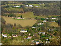
Bishopswood
The scattering of houses are linked by the steep lane ascending the eastern slope of the Wye Gorge near Kerne Bridge.
Viewed from near the top of Coppet Hill.
Image: © Jonathan Billinger
Taken: 21 Feb 2009
0.18 miles
6
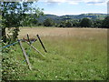
Meadow near Warren Farm
Looking south-west towards Lydbrook.
Image: © Trevor Rickard
Taken: 31 Jul 2007
0.19 miles
7
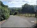
Top of the hill at Kerne Bridge
From this point, the lane descends steeply towards Kerne Bridge village.
Image: © Trevor Rickard
Taken: 31 Jul 2007
0.21 miles
8
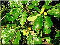
Autumnal oak
Close-up of a fine oak tree near Bishopswood.
Image: © Jonathan Billinger
Taken: 26 Sep 2008
0.21 miles
9
![A walk from Kerne Bridge to Ross-on-Wye [11]](https://s2.geograph.org.uk/geophotos/07/35/08/7350814_31940838_120x120.jpg)
A walk from Kerne Bridge to Ross-on-Wye [11]
The route follows this track, now a public bridleway.
The walk leaves Kerne Bridge, ascends Ley Hill then takes a bridleway through Warren Wood to Forest Green. A minor road is then followed to Bull’s Hill where the long distance Wye Valley Walk is joined. Bridleways and footpaths are then taken to Coughton and the start of the steep ascent through Chase Wood to the hillfort on top of the plateau. A descent through Merrivale Wood takes the route to its destination in Ross-on-Wye. About 4½ miles.
Image: © Michael Dibb
Taken: 1 Sep 2022
0.22 miles
10
![A walk from Kerne Bridge to Ross-on-Wye [13]](https://s1.geograph.org.uk/geophotos/07/35/15/7351549_fedf2fbe_120x120.jpg)
A walk from Kerne Bridge to Ross-on-Wye [13]
The bridleway runs through Warren Wood.
The walk leaves Kerne Bridge, ascends Ley Hill then takes a bridleway through Warren Wood to Forest Green. A minor road is then followed to Bull’s Hill where the long distance Wye Valley Walk is joined. Bridleways and footpaths are then taken to Coughton and the start of the steep ascent through Chase Wood to the hillfort on top of the plateau. A descent through Merrivale Wood takes the route to its destination in Ross-on-Wye. About 4½ miles.
Image: © Michael Dibb
Taken: 1 Sep 2022
0.23 miles