
IMAGES TAKEN NEAR TO
Kerne Bridge, ROSS-ON-WYE, HR9 5QT
Introduction
This page details the photographs taken nearby to HR9 5QT by members of the Geograph project.
The Geograph project started in 2005 with the aim of publishing, organising and preserving representative images for every square kilometre of Great Britain, Ireland and the Isle of Man.

There are currently over 7.5m images from over14,400 individuals and you can help contribute to the project by visiting https://www.geograph.org.uk
Image Map
Images are licensed for reuse under creativecommons.org/licenses/by-sa/2.0
Notes
- Clicking on the map will re-center to the selected point.
- The higher the marker number, the further away the image location is from the centre of the postcode.
Image Listing (145 Images Found)
Images are licensed for reuse under creativecommons.org/licenses/by-sa/2.0
Image
Details
Distance
1
![A walk from Kerne Bridge to Ross-on-Wye [6]](https://s3.geograph.org.uk/geophotos/07/35/08/7350807_a10d3900_120x120.jpg)
A walk from Kerne Bridge to Ross-on-Wye [6]
The path climbs steeply through this green tunnel between houses as it ascends Ley Hill.
The walk leaves Kerne Bridge, ascends Ley Hill then takes a bridleway through Warren Wood to Forest Green. A minor road is then followed to Bull’s Hill where the long distance Wye Valley Walk is joined. Bridleways and footpaths are then taken to Coughton and the start of the steep ascent through Chase Wood to the hillfort on top of the plateau. A descent through Merrivale Wood takes the route to its destination in Ross-on-Wye. About 4½ miles.
Image: © Michael Dibb
Taken: 1 Sep 2022
0.01 miles
2
![A walk from Kerne Bridge to Ross-on-Wye [7]](https://s0.geograph.org.uk/geophotos/07/35/08/7350808_1bb14b18_120x120.jpg)
A walk from Kerne Bridge to Ross-on-Wye [7]
On its ascent of Ley Hill, the path follows this drive.
The walk leaves Kerne Bridge, ascends Ley Hill then takes a bridleway through Warren Wood to Forest Green. A minor road is then followed to Bull’s Hill where the long distance Wye Valley Walk is joined. Bridleways and footpaths are then taken to Coughton and the start of the steep ascent through Chase Wood to the hillfort on top of the plateau. A descent through Merrivale Wood takes the route to its destination in Ross-on-Wye. About 4½ miles.
Image: © Michael Dibb
Taken: 1 Sep 2022
0.02 miles
3

Bishopswood from Coppett Hill
Community on the steep east slope of the Wye valley.
Image: © Jonathan Billinger
Taken: 19 Jan 2015
0.02 miles
4
![A walk from Kerne Bridge to Ross-on-Wye [5]](https://s2.geograph.org.uk/geophotos/07/35/08/7350806_5e15b83f_120x120.jpg)
A walk from Kerne Bridge to Ross-on-Wye [5]
The public footpath, here part of the long distance Wye Valley Walk, runs up this drive.
The walk leaves Kerne Bridge, ascends Ley Hill then takes a bridleway through Warren Wood to Forest Green. A minor road is then followed to Bull’s Hill where the long distance Wye Valley Walk is joined. Bridleways and footpaths are then taken to Coughton and the start of the steep ascent through Chase Wood to the hillfort on top of the plateau. A descent through Merrivale Wood takes the route to its destination in Ross-on-Wye. About 4½ miles.
Image: © Michael Dibb
Taken: 1 Sep 2022
0.03 miles
5
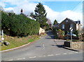
Road from Bishopswood to Leys Hill and Howle Hill
Viewed across the B4234.
Image: © Jaggery
Taken: 24 Feb 2012
0.03 miles
6
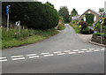
Unclassified road ascending from the B4234 in Bishopswood
The 40mph speed limit on the B4234 increases to the National Speed Limit.
The blue sign on the left shows that the route ahead is unsuitable for heavy goods vehicles.
A sign http://www.geograph.org.uk/photo/5001855 near the camera shows that this road leads to Leys Hill (1 mile) and Howle Hill (2 miles).
Image: © Jaggery
Taken: 19 Jun 2016
0.03 miles
7
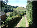
Footpath at Kerne Bridge
This public footpath climbs steeply up the hillside, using several house driveways as it goes. Here we look westwards towards the low hill at Goodrich on the other side of the Wye, but the river is not visible.
Image: © Trevor Rickard
Taken: 31 Jul 2007
0.03 miles
8
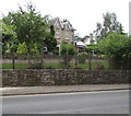
Lumleys Guesthouse, Bishopswood
Set above the B4234 and the River Wye, near Kerne Bridge.
Image: © Jaggery
Taken: 19 Jun 2016
0.04 miles
9
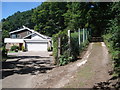
Coombe Lodge at Kerne Bridge
The public footpath climbs to the right past this attractive house, which overlooks the valley to the left.
Image: © Trevor Rickard
Taken: 31 Jul 2007
0.04 miles
10
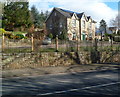
Lumleys Guest House, Bishopswood
Set above the B4234 on the north bank of the River Wye, SE of Kerne Bridge.
Image: © Jaggery
Taken: 24 Feb 2012
0.05 miles