
IMAGES TAKEN NEAR TO
Bromsberrow, LEDBURY, HR8 1SB
Introduction
This page details the photographs taken nearby to HR8 1SB by members of the Geograph project.
The Geograph project started in 2005 with the aim of publishing, organising and preserving representative images for every square kilometre of Great Britain, Ireland and the Isle of Man.

There are currently over 7.5m images from over14,400 individuals and you can help contribute to the project by visiting https://www.geograph.org.uk
Image Map
Images are licensed for reuse under creativecommons.org/licenses/by-sa/2.0
Notes
- Clicking on the map will re-center to the selected point.
- The higher the marker number, the further away the image location is from the centre of the postcode.
Image Listing (12 Images Found)
Images are licensed for reuse under creativecommons.org/licenses/by-sa/2.0
Image
Details
Distance
1
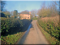
Eggs Tump
Looking north along the narrow lane to cottages at Eggs Tump.
Image: © Trevor Rickard
Taken: 1 Jan 2010
0.03 miles
2
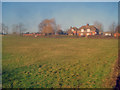
The Kennels at Eggs Tump
Large house and outbuildings at Eggs Tump. Home of the Ledbury Hunt pack and venue for various hunt social events.
http://www.ledburyhunt.co.uk/index.html
Image: © Trevor Rickard
Taken: 1 Jan 2010
0.05 miles
3
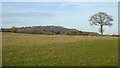
View to Chase End Hill
View to Chase End Hill from near Cobb's Cross.
Image: © Philip Halling
Taken: 14 Dec 2016
0.12 miles
4
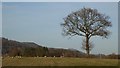
Tree in field
Tree in a field near Cobb's Cross, the Malvern Hills can be just glimpsed in the distance.
Image: © Philip Halling
Taken: 14 Dec 2016
0.12 miles
5

Arable land at King's Green
Here is a similar view in December 2020 Image Bredon Hill is in the distance.
Image: © Philip Halling
Taken: 5 Jan 2026
0.13 miles
6
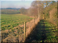
Public footpath near Eggs Tump
Looking west down the path, which is fenced off from the rest of the field. Aubreys Farm in the distance on the left.
Image: © Trevor Rickard
Taken: 1 Jan 2010
0.15 miles
7
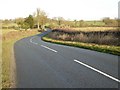
Minor road near King's Green
Minor road connecting the A417 and B4208 pictured here near King's Green.
Image: © Philip Halling
Taken: 14 Dec 2016
0.18 miles
9
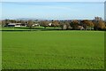
Farmland at King's Green
Arable farmland at King's Green. Bredon Hill is on the horizon,
Image: © Philip Halling
Taken: 1 Dec 2020
0.19 miles
10
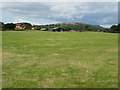
House and buildings at Cobb's Cross
In the background is Chase End, the most southerly of the Malvern Hills. Notice a wind sock flying in front of the green shed.
Image: © Philip Halling
Taken: 13 Jul 2008
0.20 miles