IMAGES TAKEN NEAR TO
Bosbury, LEDBURY, HR8 1JZ

Introduction

This page details the photographs taken nearby to HR8 1JZ by members of the Geograph project.

The Geograph project started in 2005 with the aim of publishing, organising and preserving representative images for every square kilometre of Great Britain, Ireland and the Isle of Man.

There are currently over 7.5m images from over14,400 individuals and you can help contribute to the project by visiting https://www.geograph.org.uk

Image Map


Images are licensed for reuse under creativecommons.org/licenses/by-sa/2.0
Notes
  • Clicking on the map will re-center to the selected point.
  • The higher the marker number, the further away the image location is from the centre of the postcode.

Image Listing (12 Images Found)

Images are licensed for reuse under creativecommons.org/licenses/by-sa/2.0
Image
Details
Distance
1
Bosbury House
Pevsner describes Bosbury House as 'Georgian with additions in 1873'. Here the house is viewed from the B4220.
Image: © Philip Halling Taken: 24 Oct 2009
0.02 miles
2
Bosbury House
Bosbury House is a Grade II listed building https://historicengland.org.uk/listing/the-list/list-entry/1302712. The listing describes it a former hunting lodge which was substantially altered in 1873. Here it is viewed from the passing B4220. I previously photographed it in 2009 Image
Image: © Philip Halling Taken: 7 Nov 2020
0.03 miles
3
Hop Bines For Sale
Yes, we're in Herefordshire at hop-picking time. The fields beyond the side are usually sheep grazing.
Image: © Peter Whatley Taken: 2 Sep 2008
0.07 miles
4
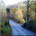
B4220 looking towards Bosbury
Image: © Rob Purvis Taken: 28 May 2014
0.10 miles
5
The B4220 near Bosbury
The B4220 near Bosbury House to the east of Bosbury.
Image: © Philip Halling Taken: 24 Oct 2009
0.13 miles
6
Colwall road
The route between Bosbury and Colwall passes through some wooded country, especially here by Bosbury House.
Image: © Jonathan Billinger Taken: 14 Nov 2014
0.15 miles
7
Tree opposite Bosbury House
Tree and house opposite Bosbury House.
Image: © Philip Halling Taken: 24 Oct 2009
0.15 miles
8
Building at Bosbury House Farm
Looks like older-style poultry units here.
Image: © Jonathan Billinger Taken: 14 Nov 2014
0.15 miles
9
Old Milestone by the B4220, Ailscroft, Bosbury parish
Carved stone post by the B4220, in parish of BOSBURY (District), Ailscroft, by hedge, at corner near chevrons, on East side of road. Ledbury stone, erected by the Ledbury turnpike trust in the 19th century. Inscription reads:- TO LEDBURY 5 MILES WORCESTER 13 MILES Grade II listed. List Entry Number: 1098923 https://historicengland.org.uk/listing/the-list/list-entry/1098923 Milestone Society National ID: HF_LBWO05.
Image: © Robert Walker Taken: 3 Mar 2012
0.16 miles
10
Grazing land near Pow Green
Grazing land near Pow Green to the east of Bosbury.
Image: © Philip Halling Taken: 24 Oct 2009
0.17 miles