Bosbury House
Introduction
The photograph on this page of Bosbury House by Philip Halling as part of the Geograph project.
The Geograph project started in 2005 with the aim of publishing, organising and preserving representative images for every square kilometre of Great Britain, Ireland and the Isle of Man.

There are currently over 7.5m images from over 14,400 individuals and you can help contribute to the project by visiting https://www.geograph.org.uk
Bosbury House
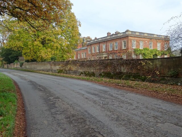
Image: © Philip Halling Taken: 7 Nov 2020
Bosbury House is a Grade II listed building https://historicengland.org.uk/listing/the-list/list-entry/1302712. The listing describes it a former hunting lodge which was substantially altered in 1873. Here it is viewed from the passing B4220. I previously photographed it in 2009 Image
Images are licensed for reuse under creativecommons.org/licenses/by-sa/2.0
Image Location
Latitude
52.093369
Longitude
-2.432595