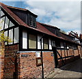
IMAGES TAKEN NEAR TO
Church Lane, LEDBURY, HR8 1DL

Introduction

This page details the photographs taken nearby to Church Lane, HR8 1DL by members of the Geograph project.

The Geograph project started in 2005 with the aim of publishing, organising and preserving representative images for every square kilometre of Great Britain, Ireland and the Isle of Man.

There are currently over 7.5m images from over14,400 individuals and you can help contribute to the project by visiting https://www.geograph.org.uk

Image Map


Images are licensed for reuse under creativecommons.org/licenses/by-sa/2.0
Notes
  • Clicking on the map will re-center to the selected point.
  • The higher the marker number, the further away the image location is from the centre of the postcode.

Image Listing (865 Images Found)

Images are licensed for reuse under creativecommons.org/licenses/by-sa/2.0
  • ...
Image
Details
Distance
1
Ledbury - Church Lane
Image: © Colin Park Taken: 11 Sep 2012
0.00 miles
2
Church Street
Image: © Oast House Archive Taken: 17 Aug 2013
0.00 miles
3
Church Lane, Ledbury
At dusk. Compare with a daytime view Image
Image: © Ian Taylor Taken: 14 Jan 2014
0.00 miles
4
Public toilets, Church Lane, Ledbury
A most welcome non-medieval addition to a medieval lane in the centre of Ledbury.
Image: © Jaggery Taken: 19 May 2013
0.00 miles
5
Church Lane
The Prince of Wales free house on Church Lane in Ledbury.
Image: © Philip Halling Taken: 8 Jun 2022
0.00 miles
6
Church Lane, Ledbury
Photogenic pedestrianised lane in the town centre.
Image: © Jonathan Billinger Taken: 9 Jul 2022
0.00 miles
7
Church Lane, Ledbury
On the immediate left are the grade II* listed Town Council Offices https://historicengland.org.uk/listing/the-list/list-entry/1082903?section=official-list-entry . Further on are "public lavatories discreetly installed in an old range of outbuildings, probably C17, timber-framed with brick and plaster panels" https://historicengland.org.uk/listing/the-list/list-entry/1301844?section=official-list-entry . On the immediate right is No 1 Church Lane https://historicengland.org.uk/listing/the-list/list-entry/1082875?section=official-list-entry . Northward views along the urban lane (here used by the Geopark Way) are rendered even more attractive by the spire of St Michael's church.
Image: © Derek Harper Taken: 16 Jul 2021
0.00 miles
8
Church Lane seen from Church Street
The classic view looking up the cobbled Church Lane towards St Michael & All Angels. The lane is lined with 16th C buildings (council offices) & the old grammar school, now an heritage centre. It also includes a house from Butchers Row, moved from nearer the market house and now on its 3rd site housing the folk museum.
Image: © David Stowell Taken: 26 Jan 2007
0.01 miles
9
Ledbury market house
Christmas eve flowers at the Market house.
Image: © cynthia hudson Taken: 24 Dec 2011
0.01 miles
10
Church Lane, Ledbury
View up Church Lane from junction with High Street. Several interesting buildings including the Museum and Church are located here.
Image: © Clint Mann Taken: 28 Mar 2014
0.01 miles
  • ...