Church Lane, Ledbury
Introduction
The photograph on this page of Church Lane, Ledbury by Derek Harper as part of the Geograph project.
The Geograph project started in 2005 with the aim of publishing, organising and preserving representative images for every square kilometre of Great Britain, Ireland and the Isle of Man.

There are currently over 7.5m images from over 14,400 individuals and you can help contribute to the project by visiting https://www.geograph.org.uk
Church Lane, Ledbury
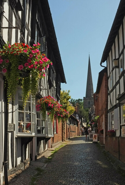
Image: © Derek Harper Taken: 16 Jul 2021
On the immediate left are the grade II* listed Town Council Offices https://historicengland.org.uk/listing/the-list/list-entry/1082903?section=official-list-entry . Further on are "public lavatories discreetly installed in an old range of outbuildings, probably C17, timber-framed with brick and plaster panels" https://historicengland.org.uk/listing/the-list/list-entry/1301844?section=official-list-entry . On the immediate right is No 1 Church Lane https://historicengland.org.uk/listing/the-list/list-entry/1082875?section=official-list-entry . Northward views along the urban lane (here used by the Geopark Way) are rendered even more attractive by the spire of St Michael's church.
Images are licensed for reuse under creativecommons.org/licenses/by-sa/2.0
Image Location
Latitude
52.037125
Longitude
-2.422284