IMAGES TAKEN NEAR TO
Hillfield Drive, LEDBURY, HR8 1BH
Introduction
This page details the photographs taken nearby to Hillfield Drive, HR8 1BH by members of the Geograph project.
The Geograph project started in 2005 with the aim of publishing, organising and preserving representative images for every square kilometre of Great Britain, Ireland and the Isle of Man.

There are currently over 7.5m images from over14,400 individuals and you can help contribute to the project by visiting https://www.geograph.org.uk
Image Map
Images are licensed for reuse under creativecommons.org/licenses/by-sa/2.0
Notes
- Clicking on the map will re-center to the selected point.
- The higher the marker number, the further away the image location is from the centre of the postcode.
Image Listing (747 Images Found)
Images are licensed for reuse under creativecommons.org/licenses/by-sa/2.0
Image
Details
Distance
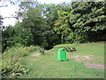
2
1970's Detached Houses on Hillfeild Drive
Image: © James Emmans
Taken: 30 Sep 2016
0.02 miles
3
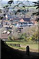
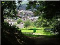
A view over the town of Ledbury
Above Ledbury there is a green lane, the former old coach road between Hereford and Worcester, here it emerges to reveal a fine view over the town of Ledbury. The clock tower can clearly be seen to the left of the centre.
Image: © Philip Halling
Taken: 26 Mar 2018
0.03 miles
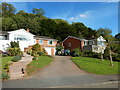
4
Picnic site overlooking Ledbury
Picnickers at this site enjoy a fine view over the town of Ledbury.
Image: © Philip Halling
Taken: 26 Mar 2018
0.04 miles
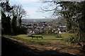
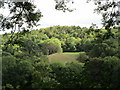
5
View over Ledbury
View over the town of Ledbury from the path at the southern end of Dog Hill Wood.
Image: © Philip Halling
Taken: 14 Jun 2018
0.05 miles
6
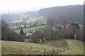
The Old Road to Ledbury
Looking down from the side of Bradlow Knoll along what was probably an old road through Bradlow, along an existing stretch of road then along the byway along the edge of Dog Hill Wood to Ledbury. The spire of the church in Ledbury can be seen in the distance.
Image: © Bob Embleton
Taken: 18 Feb 2007
0.05 miles
8
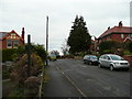
Bank Crescent, Ledbury
A suburban scene to the north of the town centre. Development seems to date back to early 20th century.
Image: © Jonathan Billinger
Taken: 31 Dec 2007
0.09 miles
9
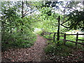
Footpath to Worcester Road
Leads off Dog Lane.
Image: © Jonathan Thacker
Taken: 13 Sep 2018
0.11 miles
10
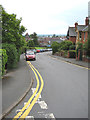
Bank Crescent, Ledbury
Looking towards the town. The memorial tower of the Barrett Browning Institute provides a clear landmark.
Image: © Pauline E
Taken: 30 May 2008
0.11 miles