
IMAGES TAKEN NEAR TO
Church Street, LEOMINSTER, HR6 9UE
Introduction
This page details the photographs taken nearby to Church Street, HR6 9UE by members of the Geograph project.
The Geograph project started in 2005 with the aim of publishing, organising and preserving representative images for every square kilometre of Great Britain, Ireland and the Isle of Man.

There are currently over 7.5m images from over14,400 individuals and you can help contribute to the project by visiting https://www.geograph.org.uk
Image Map
Images are licensed for reuse under creativecommons.org/licenses/by-sa/2.0
Notes
- Clicking on the map will re-center to the selected point.
- The higher the marker number, the further away the image location is from the centre of the postcode.
Image Listing (361 Images Found)
Images are licensed for reuse under creativecommons.org/licenses/by-sa/2.0
Image
Details
Distance
1
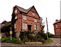
Steps House, Wigmore
Ancient brick house, precariously positioned high above the main road.
Image: © Philip Pankhurst
Taken: 27 Sep 2010
0.01 miles
2
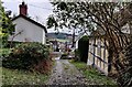
Church Street in Wigmore
Wigmore is a village in Herefordshire, about 8 miles (13 km) west of Ludlow, in the Welsh Marches.
Image: © Mat Fascione
Taken: 12 Dec 2021
0.01 miles
3
![Wigmore houses [7]](https://s3.geograph.org.uk/geophotos/06/96/77/6967719_30511403_120x120.jpg)
Wigmore houses [7]
This small house in Church Street was originally used as the Parish Hall. It was built in the 17th century and altered in the mid 19th century. Timber framed with lath-and-plaster and brick infill on a rubble stone base with a tiled roof. Listed, grade II, with details at: https://historicengland.org.uk/listing/the-list/list-entry/1302228
The village of Wigmore is set astride the A4110 road some 8 miles west of Ludlow in the northwest part of Herefordshire. An Anglo-Saxon village which, after the building of the castle, became a small but thriving market town. Wigmore declined when the castle owners moved their administrative centre to Ludlow and reverted to village status.
Image: © Michael Dibb
Taken: 1 Jun 2021
0.02 miles
4
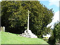
Memorial Cross St James Church Wigmore
The cross is much restored. It stands on a 14th century base, with an ogee-headed niche.
Image: © PAUL FARMER
Taken: 7 Apr 2009
0.02 miles
5
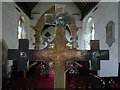
Brass Cross inside St. James' Church (Chancel | Wigmore)
Placed on the altar inside the chancel is this brass cross, which I never looked at in detail until this day. When I looked at the back of the cross, I saw that it had the name of the church on it! Very cool.
Image: © Fabian Musto
Taken: 13 Jul 2019
0.02 miles
6
![Parish church [3]](https://s2.geograph.org.uk/geophotos/06/96/76/6967650_e83d7ed7_120x120.jpg)
Parish church [3]
Part of the churchyard with the cross which is seen at Image
The Anglican parish church of St James was built in the 11th century, partly rebuilt and extended in the 14th century, altered in the 15th century and restored in 1864. The nave has some 11th century herringbone masonry, and the rest of the church is of rubble stone under slate roofs. Inside there is an octagonal medieval font and many memorials. Listed, grade I, with details at: https://historicengland.org.uk/listing/the-list/list-entry/1178822
The village of Wigmore is set astride the A4110 road some 8 miles west of Ludlow in the northwest part of Herefordshire. An Anglo-Saxon village which, after the building of the castle, became a small but thriving market town. Wigmore declined when the castle owners moved their administrative centre to Ludlow and reverted to village status.
Image: © Michael Dibb
Taken: 1 Jun 2021
0.02 miles
7
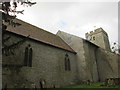
St. James' Church (Wigmore)
Here is a view of the entire church from the churchyard.
Image: © Fabian Musto
Taken: 20 Feb 2018
0.02 miles
8
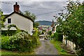
Wigmore: The track to St. James' Church from the A4110
Image: © Michael Garlick
Taken: 14 Aug 2015
0.02 miles
9
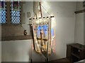
Banner inside St. James church (Wigmore)
This banner is situated at the east end of the north wall in the chancel, with a reflection of a two-light stained-glass window in view.
Image: © Fabian Musto
Taken: 9 Dec 2022
0.02 miles
10

St. James' Church (Wigmore)
Taken from the path leading up to both the church and castle.
Image: © Fabian Musto
Taken: 20 Feb 2018
0.02 miles