IMAGES TAKEN NEAR TO
Ebnall, LEOMINSTER, HR6 9AL
Introduction
This page details the photographs taken nearby to HR6 9AL by members of the Geograph project.
The Geograph project started in 2005 with the aim of publishing, organising and preserving representative images for every square kilometre of Great Britain, Ireland and the Isle of Man.

There are currently over 7.5m images from over14,400 individuals and you can help contribute to the project by visiting https://www.geograph.org.uk
Image Map
Images are licensed for reuse under creativecommons.org/licenses/by-sa/2.0
Notes
- Clicking on the map will re-center to the selected point.
- The higher the marker number, the further away the image location is from the centre of the postcode.
Image Listing (7 Images Found)
Images are licensed for reuse under creativecommons.org/licenses/by-sa/2.0
Image
Details
Distance
1

Old Toll House by the B4529, Cholstrey Road, Ebnall Bank
Toll House in the parish of Leominster (Herefordshire District), The Old Toll House, Ebnall Bank, Cholstrey Road (B4529), HR6 9AL.
Grade II listed.
List Entry Number: 1270376 https://historicengland.org.uk/listing/the-list/list-entry/1270376
Surveyed
Milestone Society National ID: HF.LEO01
Image: © Alan Rosevear
Taken: 23 May 2006
0.01 miles
3
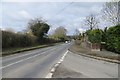
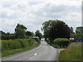
Cholstrey Road, Leominster
Now numbered B4529, this was once the A44 out of Leominster before it was rerouted along Monkland Road in the late 1970s. It is still a busy road, mainly with traffic from Kingsland and beyond.
Image: © Richard Webb
Taken: 4 Apr 2015
0.05 miles
4
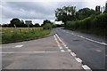
Ginhall Lane and B4529 junction
Ginhall Lane junction with the B4529 on the western edge of Leominster.
Image: © Philip Halling
Taken: 23 Jul 2016
0.10 miles