
IMAGES TAKEN NEAR TO
Battlebridge Close, LEOMINSTER, HR6 8TH
Introduction
This page details the photographs taken nearby to Battlebridge Close, HR6 8TH by members of the Geograph project.
The Geograph project started in 2005 with the aim of publishing, organising and preserving representative images for every square kilometre of Great Britain, Ireland and the Isle of Man.

There are currently over 7.5m images from over14,400 individuals and you can help contribute to the project by visiting https://www.geograph.org.uk
Image Map
Images are licensed for reuse under creativecommons.org/licenses/by-sa/2.0
Notes
- Clicking on the map will re-center to the selected point.
- The higher the marker number, the further away the image location is from the centre of the postcode.
Image Listing (174 Images Found)
Images are licensed for reuse under creativecommons.org/licenses/by-sa/2.0
Image
Details
Distance

2
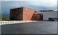
Earl Mortimer College, Leominster
Located on the east side of South Street, Earl Mortimer College and Sixth Form Centre opened in 2010, replacing Minster College.
Image: © Jaggery
Taken: 22 Apr 2012
0.12 miles
3
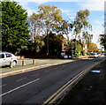
East along Coningsby Road, Leominster
From South Street, Coningsby Road leads to Eaton Close.
Image: © Jaggery
Taken: 16 Oct 2019
0.14 miles
5
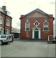
Grade II listed Leominster Baptist Church
Set back 20 metres from the south side of Etnam Street. The year 1771 is inscribed above the bulls-eye window above the doorway. Grade II listed in July 1954.
Image: © Jaggery
Taken: 22 Apr 2012
0.15 miles
6
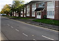
Coningsby Road flats, Leominster
On the south side of the road, east of the B4361 South Street.
Image: © Jaggery
Taken: 16 Oct 2019
0.15 miles
7
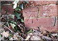
Ordnance Survey Cut Mark
This OS cut mark can be found on a brick post north of the footpath. It marks a point 74.972m above mean sea level.
Image: © Adrian Dust
Taken: 12 Mar 2017
0.16 miles
8
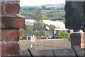
BPI (Leominster)
Leominster's bad luck, viewed from the roof at my granddad's house.
Image: © Fabian Musto
Taken: 27 Sep 2018
0.16 miles
9
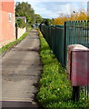
Path on the east side of South Street, Leominster
The red box is a Royal Mail drop box. https://www.geograph.org.uk/photo/6301250
Image: © Jaggery
Taken: 16 Oct 2019
0.17 miles
10
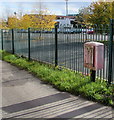
Faded red Royal Mail drop box, Leominster
Located here. https://www.geograph.org.uk/photo/6301244
Image: © Jaggery
Taken: 16 Oct 2019
0.17 miles